Archive for September 2019
A selection of Harvey’s photos
HERE IS A SMALL COLLECTION OF MARVELOUS PHOTOS not included in my other posts, which Harvey took while SleepyC and Osprey traveled together in the Broughton Archipelago and along the Inside Passage during the summer of 2019. (All captions by Harvey)
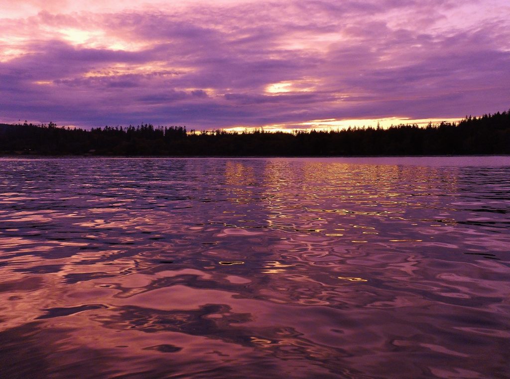
See red, violet and blue—Always looking for some red in the sunset, foretelling a good day in the morning. Mound Island Sunset (Harvey Hochstetter)
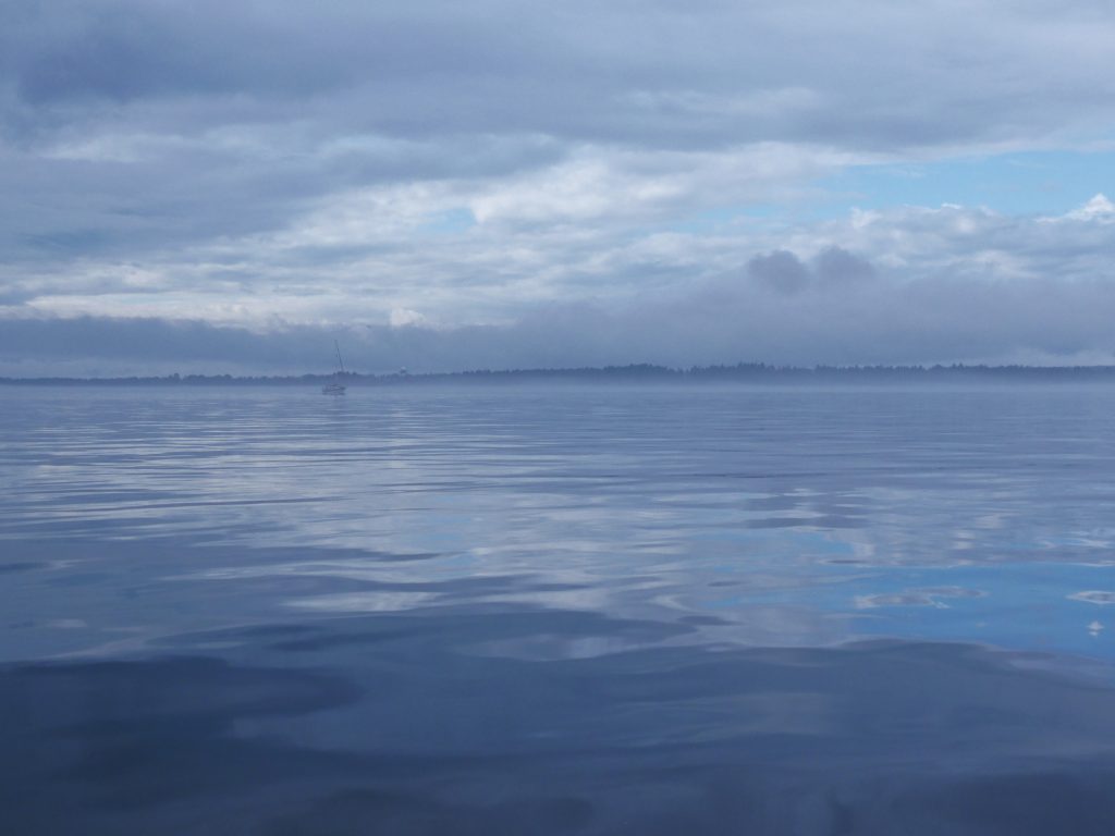
Morning not missed—Early morning, the fog dissipates and there are a few hours of quiet time before the typical winds come on the big straits. Discovery Passage (Harvey Hochstetter)
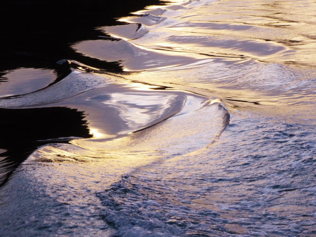
Morning mercury magic—Early morning, bright fog breaking makes silver on SleepyC’s boat wake (Harvey Hochstetter)
Steps to wonder—Thinning overhead fog allows the sun brightness to highlight the soft steps of the hard wake of Osprey. Near Bonwick Island (Harvey Hochstetter)
On point—Breaking through the fog onto flat water in Johnstone Strait, near Turn Island (Harvey Hochstetter)
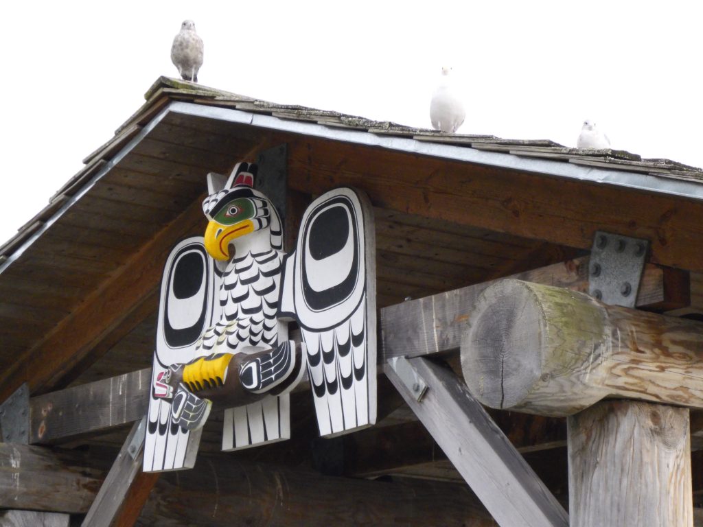
Who’s looking for me—Owl carving on a boardwalk shelter at Alert Bay, along the waterfront walk. Cormorant Island (Harvey Hochstetter)
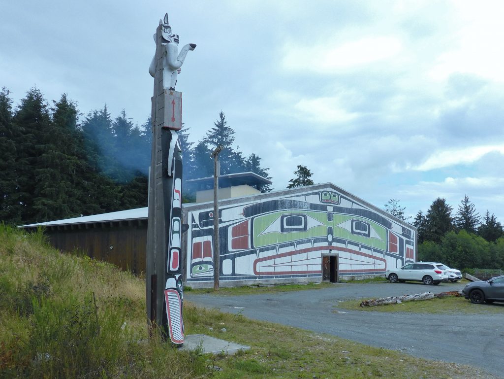
Totem and big house—Facing the community meeting place, the Big House used for special events. Alert Bay, Cormorant Island (Harvey Hochstetter)
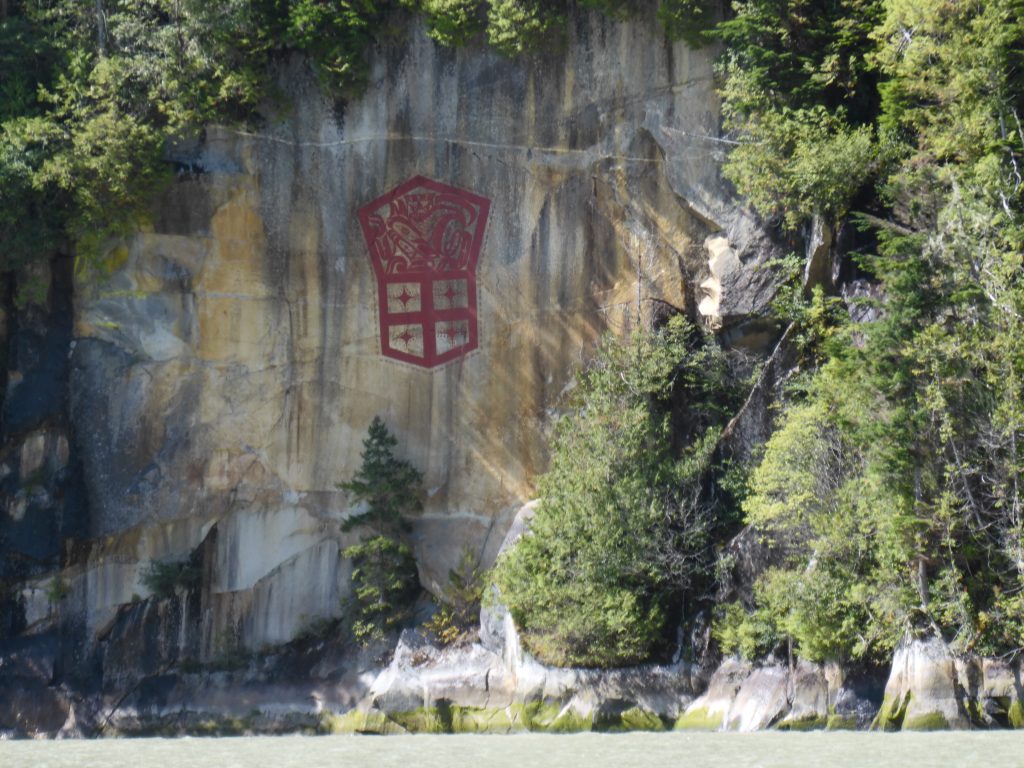
Red, bold and proud—Modern cliff drawing by First Nations artist Marianne Nicolson, a member of the Dzawada’enuxw Tribe of the Kwakwaka’wakw First Nations (Harvey Hochstetter)

Blue on blue with a touch of red—Osprey reflections near Gilford Island (Harvey Hochstetter)
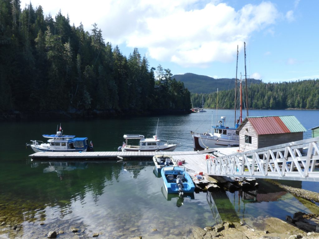
Dock or not, and away—Government dock near Shawl Bay (Harvey Hochstetter)
Editor’s note: what Harvey doesn’t mention in the above caption is that Osprey had been tied up to the dock only seconds before; that the place was swarming with no-see-ums (the bane of Andy’s existence in the north country); and that Osprey is now fleeing the horror as rapidly as possible.
On Billy Proctor’s dock, going back in time—The home of Billy Proctor, a British Columbia legend and community stalwart, is just around the corner from Echo Bay Marina, on Gilford Island (Harvey Hochstetter)
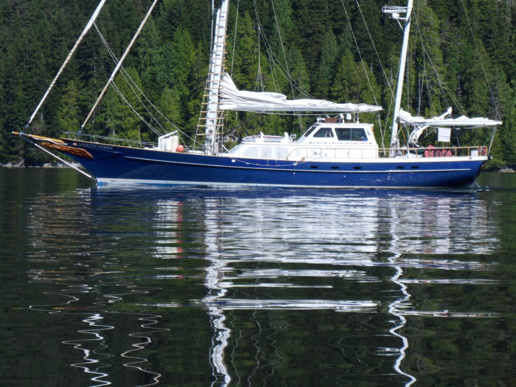
The Martin Sheen, making a statement—A sailing vessel on loan to the Sea Shepherd organization, “patrolling” the fish farms in the Broughtons, often with celebrities on board (Harvey Hochstetter)
Bound and determined in blue—Hundreds of commercial fishing vessels are not working this year but some have managed to find a use for their boats to continue to make a living (Harvey Hochstetter)
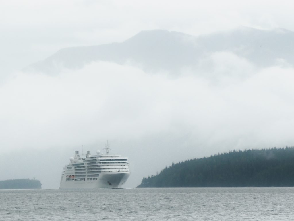
Big white on Blackney Passage, into Blackfish Sound—A cruise ship, on its way to Alaska through the Inside Passage, makes its way through an area common for both orca and humpback whales. Broughton Archipelago (Harvey Hochstetter)
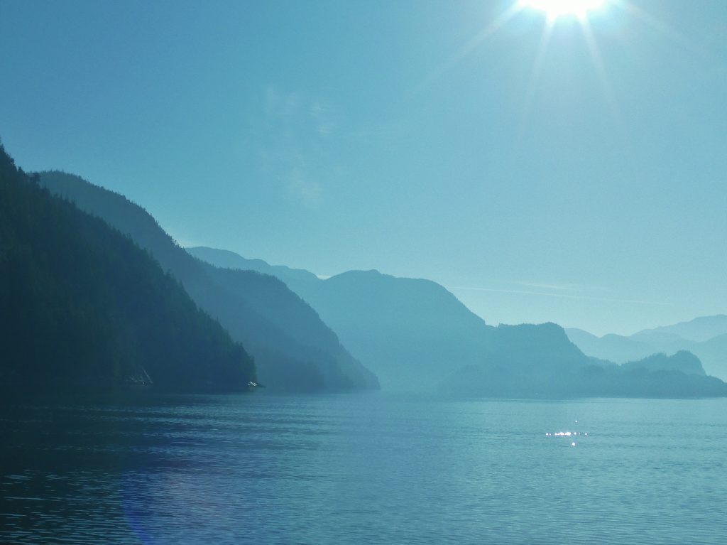
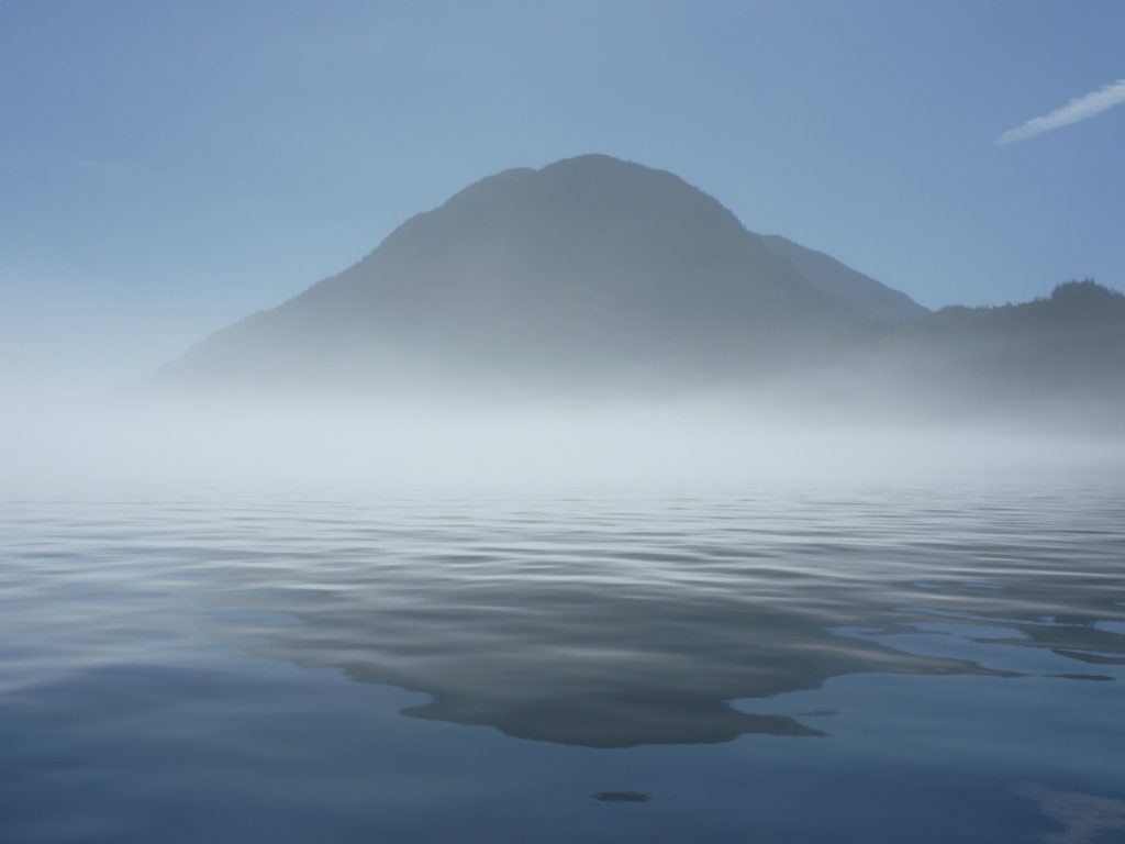
Hints to infinity—As the sun warms the air, the fog on the water dissipates and yet it lingers in the bays and canyons, accentuating the overlapping planes. Broughton Archipelago (Harvey Hochstetter)
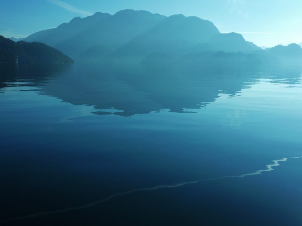
Shapes and a trail in blue—Mirror flat water reflects a contrail as the last wisps of fog hang on the edges of the islands. Broughton Archipelago (Harvey Hochstetter)
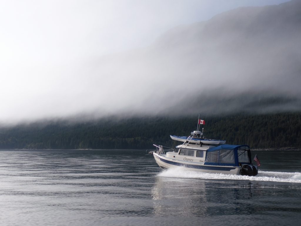
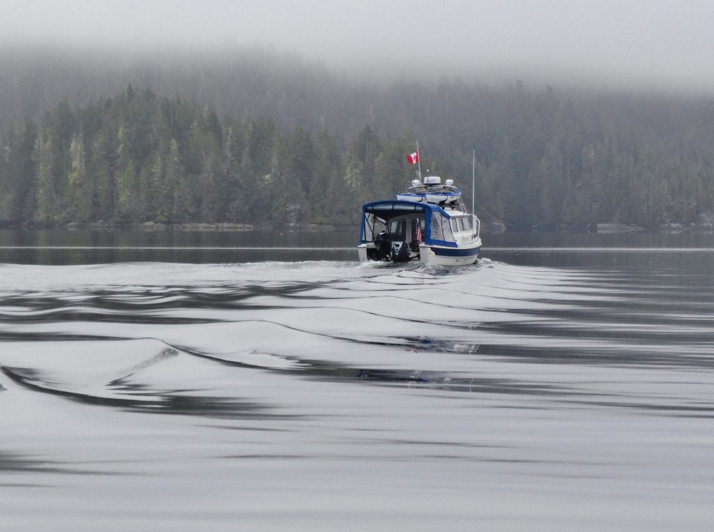
Water, rock, fog and a boat—As the fog lifts, visibility increases and allows for increase in speed, with increased safety. Johnstone Strait (Harvey Hochstetter)
Breaking Up Magic—Osprey racing toward the disappearing fog, making up for lost time. Johnstone Strait (Harvey Hochstetter)
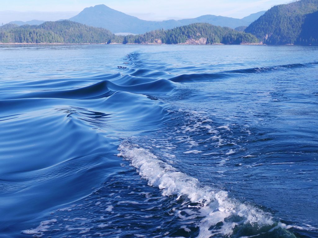
Crossed wakes, magic on the water—Traveling together, side by side, the wakes make a cross or “X.” It is relevant to the expression, “crossing wakes” used as a reference to meeting again and traveling together. Broughton Archipelago (Harvey Hochstetter)
Morning, oh for many more—The beauty of the early morning sunrise hides, barely visible in the silhouette, the ugliness of an open net pen fish farm. Berry Cove, Gilford Island. Broughton Archipelago (Harvey Hochstetter)
Almost home

Sunset at Tribune Bay
THIS IS THE LAST NIGHT OF MY TRIP. Tomorrow, my friend Jonathan will join me at Seattle’s Shilshole Marina and help me get through the Ballard Locks into freshwater Lake Washington and on to Kenmore—home—at the north end of the lake.
After I’m settled in and have the boat and my gear cleaned up and stored for the winter, I’ll write a summary post; and when he gets home, Harvey will send me some of his favorite pictures from the trip, which I’ll post here.
But, barring last-minute excitement transiting Lake Washington tomorrow, my trip is over. I have been out since May 31, 97 days, and have logged 3,674 nautical miles, or 4,228 land miles.
That’s a little more than the distance by land from Seattle to Managua, Nicaragua, or by sea from New York to London.
In the past four days, in my eagerness to get home, horse galloping for the barn, I’ve traveled about 230 nautical miles, from Campbell River, B.C. to Kingston Wash. One of those days—when I decided I can get across the border TODAY if I push it—was 110 nautical miles.
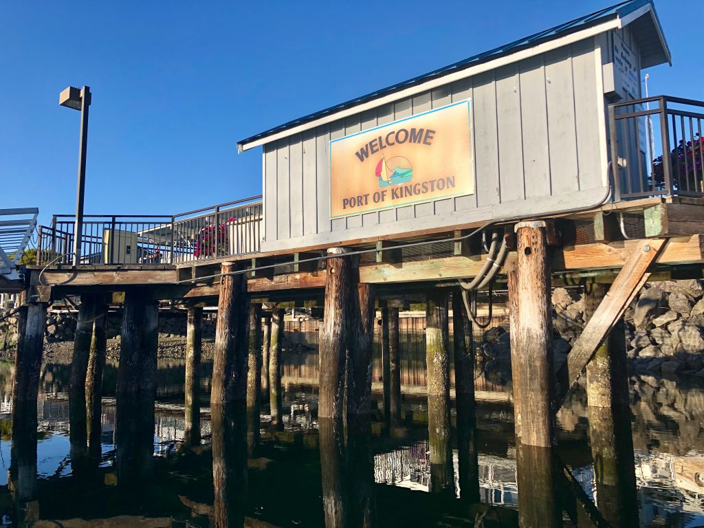
Last night out: Port of Kingston Marina, Kingston, Wash.
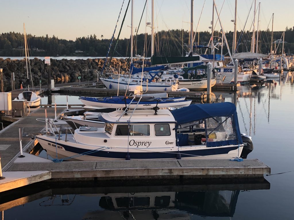
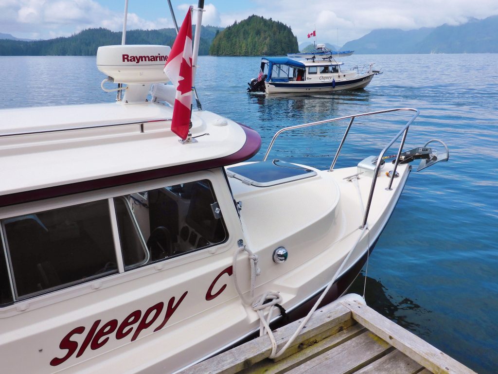
Osprey at the dock, Kingston
So I’ve been eager to get home; but it’s been a wonderful adventure. I had good luck, with the boat, my health and the weather, and I feel very fortunate to have made the trip. After I get this posted (iffy wifi at the Port of Kingston Marina), I’ll walk up the street for supper at the pub, and then turn in early for my last night afloat.
Since leaving Campbell River, I have been treated to some wonderful sights, including a gorgeous sunset at Tribune Bay, on Hornby Island, my last night in Canada. Thanks, Canadians, for being such kind, generous people. The weeks I spent in your waters were exhilarating. I hope to be back.
The last few days have been filled with … many lighthouses, including:
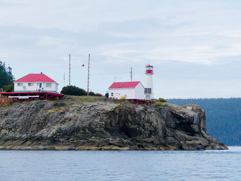
Chrome Island Lighthouse, off southern tip of Denman Island, B.C.
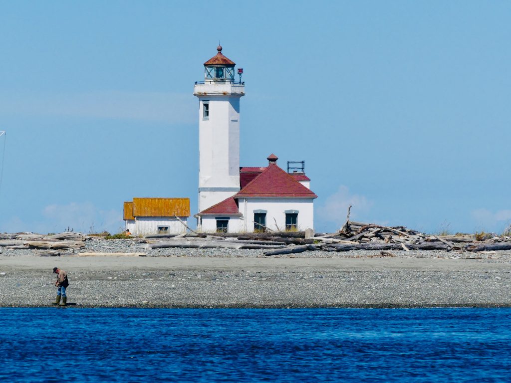
Point Wilson Light, near Port Townsend, Wash.

Point No Point Light, at the entrance to Puget Sound (almost home now)
Tuesday, I made my last “big water” crossing, about 18 nautical miles across the East Entrance of the Strait of Juan de Fuca. It’s always a good idea to treat the Strait with respect—especially at the East Entrance, which gets the full brunt of wind funneled uninterrupted down the Strait for 80 miles from the Pacific. There can be fierce winds and high seas here, but fortunately the weather was calm Tuesday.
The Strait is also known for fog, however, and as I turned the corner south, from Anacortes, down Rosario Strait and into Juan de Fuca, I hit a wall of fog and visibility dropped to a few hundred feet.

Thick fog in Strait of San Juan de Fuca
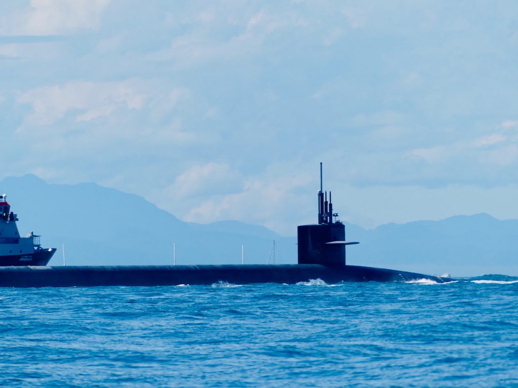
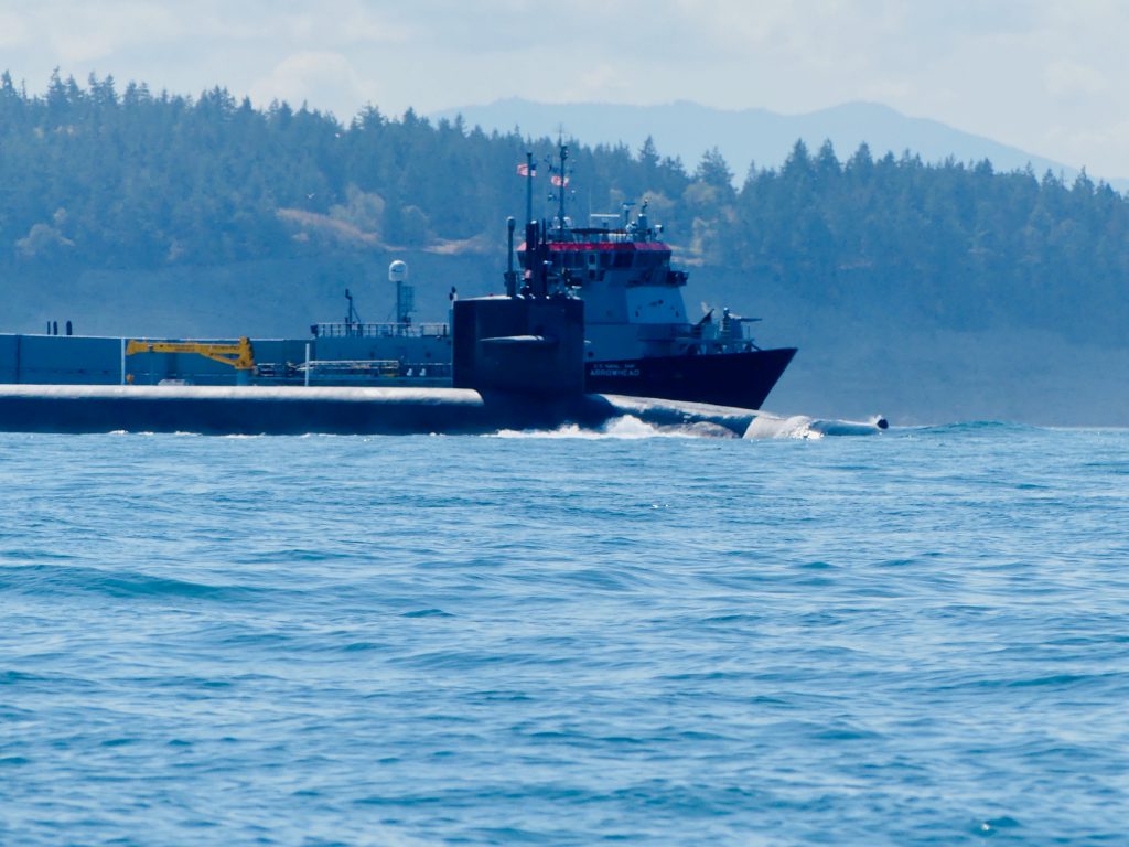
After long white-knuckle minutes, eyes glued to the radar screen, I emerged from the fog at the entrance to Admiralty Inlet—and what looked like a flotilla of vessels heading straight at me. Yipes, one of the ships appeared to be … a Trident nuclear submarine.
A red 25-foot Coast Guard Response Boat, with an M60 machine gun mounted on the bow separated itself from the the other vessels and came roaring up alongside Osprey. Hailing me on channel 16, the coasties told me they were escorting the sub out from the Trident base at Bangor. They asked me, very politely, to stay 1,000 yards from the sub—and then ran parallel beside me for several minutes to be sure I did.
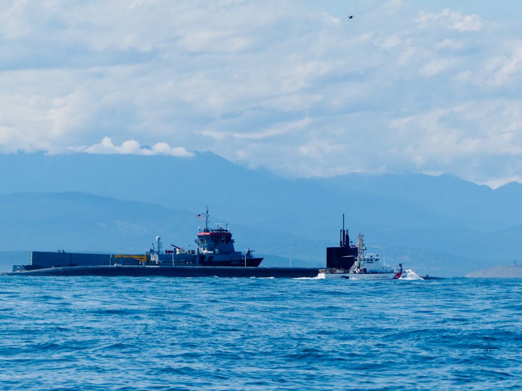
Trident sub and escort vessels at entrance to Admiralty Inlet, Olympic Mountains in background
When the sub and its escorts had passed, I motored through the churning Point Wilson tidal rip, across to Port Townsend, which is getting ready for the big annual Wooden Boat Festival, this weekend. I’m back in home waters now; back in the place I love best.

Work area at Northwest Maritime Center

Norwegian faering, under construction at the Maritime Center
Sea smoke
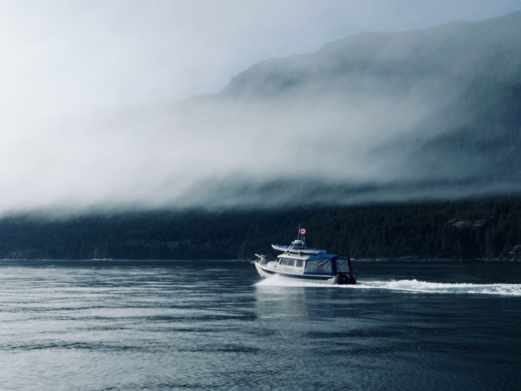
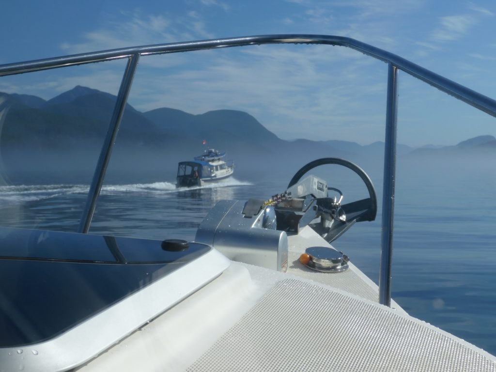
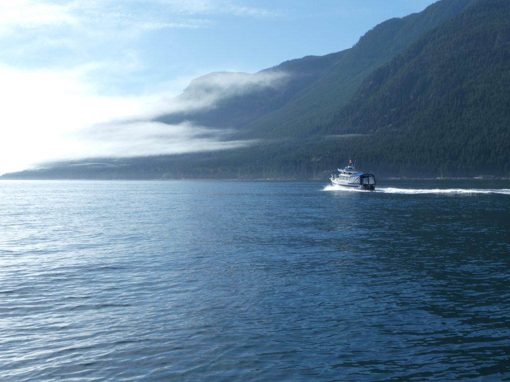
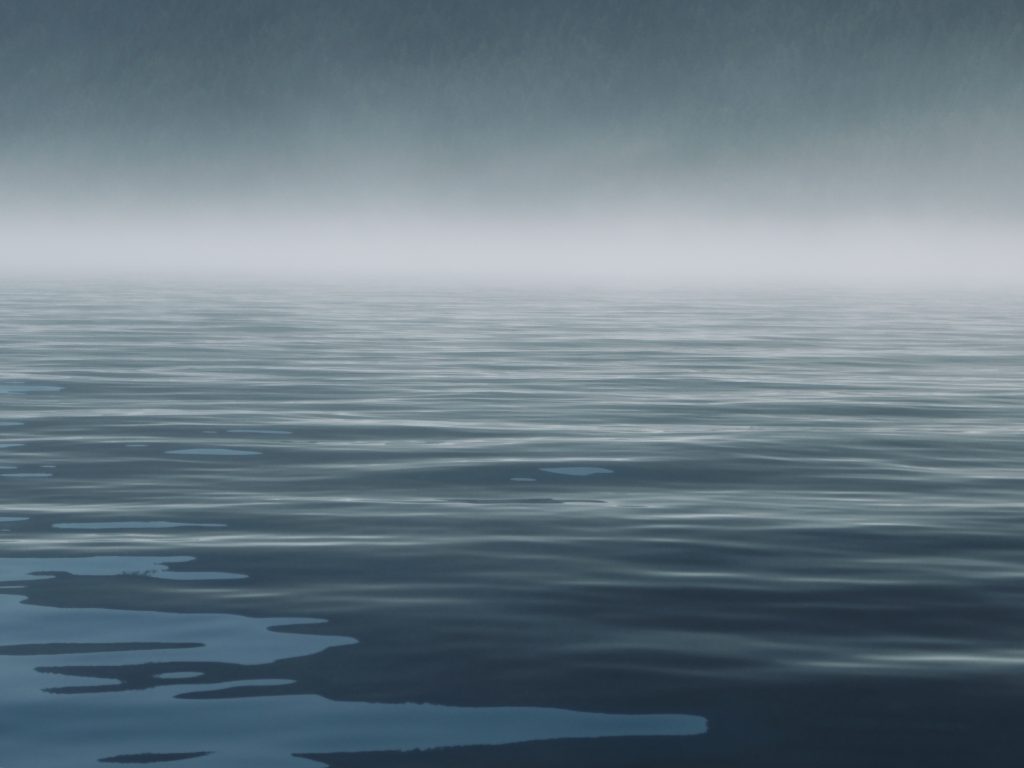
Osprey entering Johnstone Strait fog bank (Harvey Hochstetter)
WE GROPED THROUGH THICK, THICK FOG for 20 miles, inching our way down the infamous Johnstone Strait, with a 3-knot current against us. Most of the time, Harvey’s boat was out in front while I tried to keep him in sight—no easy task with visibility often less than two boat lengths.
Using radar and AIS—a technology which shows the position of boats equipped with a special transmitter—we were able to gauge the location, heading and speed of other vessels traveling in both directions along the 60-mile-long channel. Harvey radioed approaching boats, to discuss how we’d pass each other. “Green to green,” keeping their starboard, or right side, to ours; “red to red” to pass port to port.
“How thick is the fog where you are?” Harvey would ask the other boat.
“Maybe 200 feet, maybe less.”
“Same here, hard to see anything. Have a safe trip.”
Sea smoke (Harvey Hochstetter)
(Harvey Hochstetter)
When traveling in fog, you try to use all of your senses. You stare intently ahead, hoping something won’t suddenly materialize out of the murk, while simultaneously watching the navigation screen for radar blips and AIS markers. You sniff for the smell of nearby land. And you listen—for the thrum of approaching engines, the sound of waves breaking on a reef, the clang of bell buoys, for other boats’ fog horns.
Sleepy C and Osprey are equipped with automatic horns, which can be set to sound a warning every two minutes. I had used mine in dense fog several times on my trip, taking some comfort knowing other boats could at least hear my approach. But several days before we reached Johnstone Strait we’d tested our horns—at what distance could they really be heard?
The results were dismaying. We had hoped the horns would be very loud—audible at least a mile away. When put to the test, though, we learned they couldn’t be heard until the two boats were just a few feet apart.
***
In the two weeks before we entered Johnstone Strait, Harvey and I had been traveling around the Broughton Archipelago. My understanding of this area was greatly enhanced by a visit to the homestead of Billy Proctor, a legendary fisherman and logger-turned-environmentalist. Billy, who will be 85 this October, has been working for years to restore wild salmon runs that were destroyed by overfishing and horrible environmental practices including clear-cut logging, blanket spraying of pesticides, and the introduction of open pen-net salmon farms on an industrial scale.
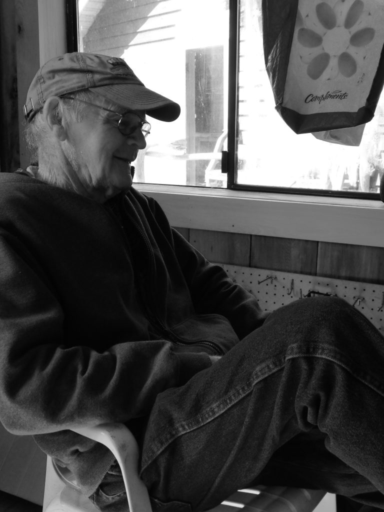
Billy Proctor (Harvey Hochstetter)
In his autobiographical book (highly recommended) Heart of the Raincoast: a Life Story, co-authored by renowned naturalist Alexandra Morton, Proctor talked about the destruction he has seen over the years:
In 1957, the BC Forest Service did an aerial spray of the north end of Vancouver Island. They sprayed from Blinkhorn Peninsula in Johnstone Strait to Cape Scott, Nigei Island and Hope Island. They sprayed with DDT and they did it in May, just when all the fry and smolts were leaving the rivers. The reason they sprayed was to kill a bug that was killing spruce trees. I was in Goletas Channel on my way home from Bull Harbour when they were spraying Nigei Island. They used two big four-engine planes and they had a thousand gallons of DDT in each plane.
There were holes along each wing and as they went there was a fog behind them. This went on for a week or more. There were stories of people with wheelbarrows full of dead tiny fry from the banks of the Nimpkish River. After that, there were no big runs of coho or springs to the Nimpkish River.
… Traditional fishing grounds were barren and who was to blame? Loggers were damming streams, preventing salmon from going upriver, and clear-cut logging was killing eggs on the spawning beds. Salmon eggs incubating in gravel need a constant flow of water to survive, and when a hillside is clear-cut, the soil washes downhill with each rainfall, clogging the little spaces between the pebbles and smothering the eggs.
Clear-cutting also warms river water, which is deadly to the cool-loving salmon. Pesticides were flowing into the creeks, poisoning juvenile fish. Relentless, increasing fishing pressure meant fewer and fewer salmon were returning to these damaged rivers, further decreasing survival. No one knew what was happening to the fish once they were out to sea. Warm currents, lack of food and increased predation kill salmon where we never see it.
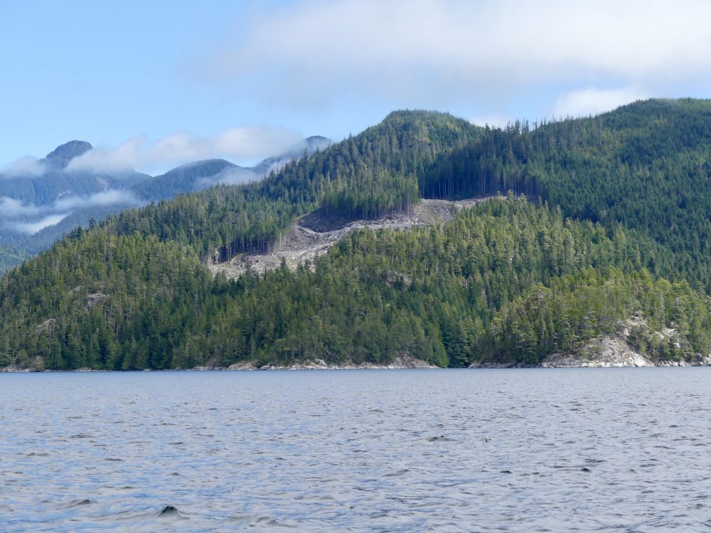
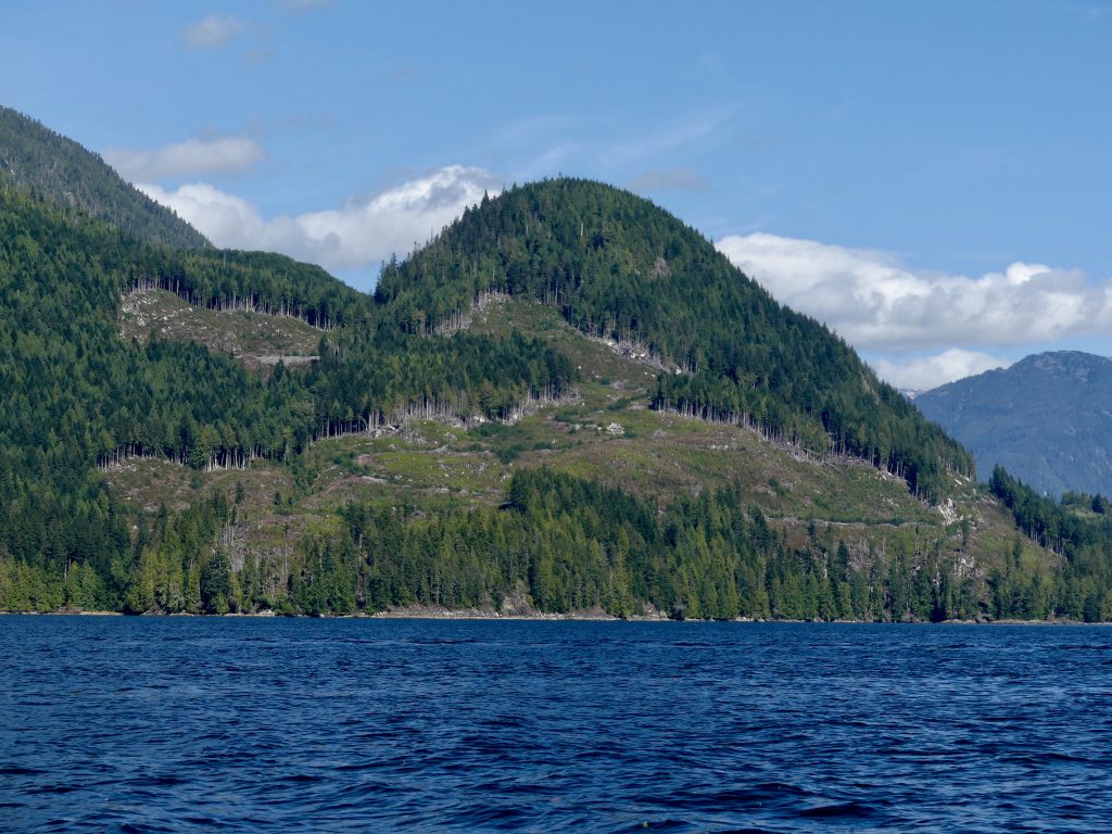
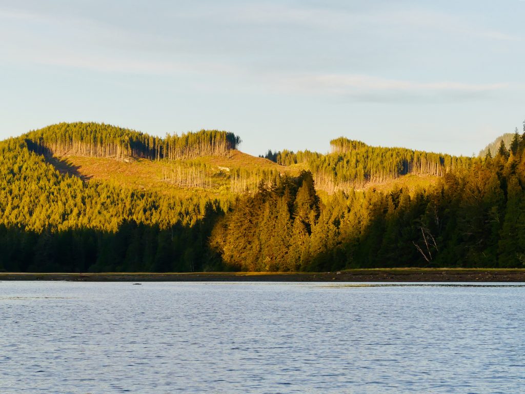
What is amazing, and infuriating, to me is that these ruinous, backward, and unsustainable—stupid—practices continue to this day, aided and abetted by the B.C. and Canadian governments. In the Broughtons we passed through channels which for majesty would rival Alaska’s famed Misty Fiords National Monument—were it not for mountains vandalized by fresh clearcuts, mile after mile, with large Atlantic salmon farms seemingly around every bend.
Here’s some of what we saw (all uncredited photos on this website by Andy Ryan):
Broughton Archipelago clearcuts
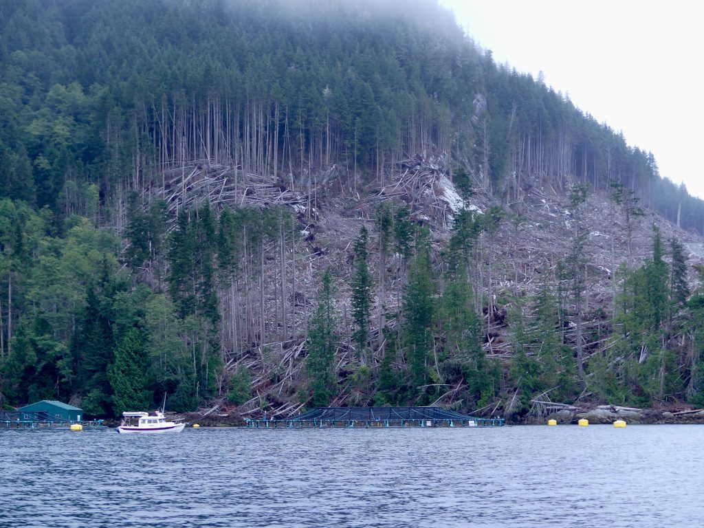
… and open net-pen fish farms
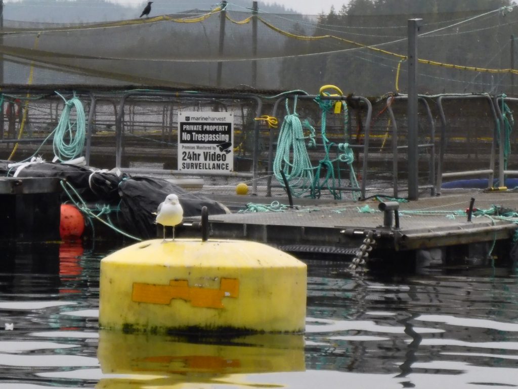
(Harvey Hochstetter)
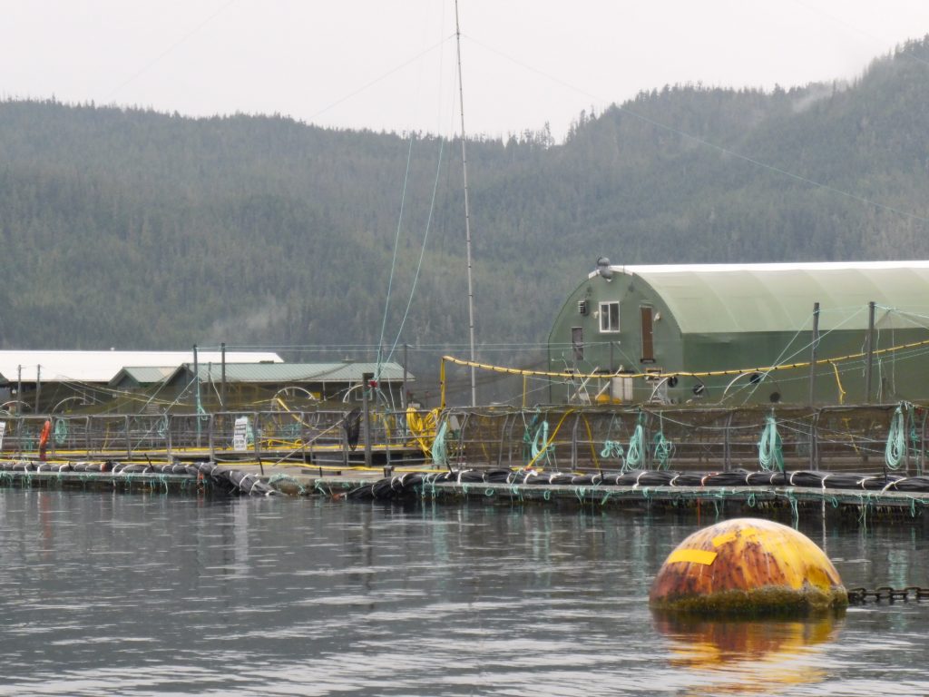
(Harvey Hochstetter)
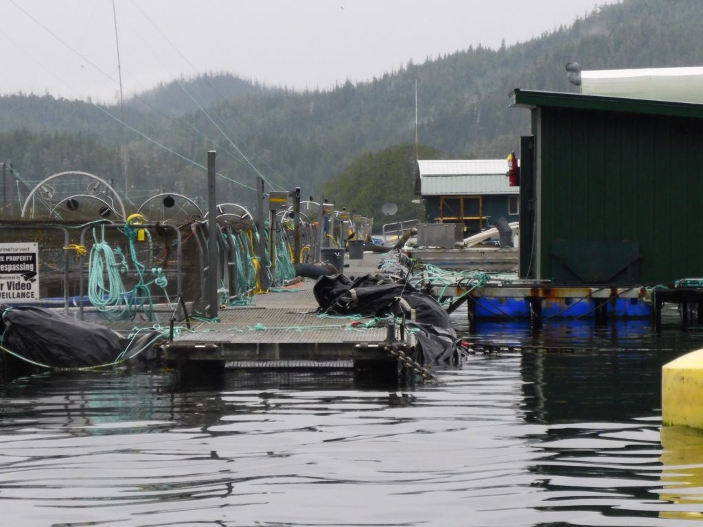
(Harvey Hochstetter)
***
Port Harvey to Campbell River, via Johnstone Strait
After four hours the fog in Johnstone Strait began to lift, and the shoreline slowly emerged. We could see again. The current had turned, going with us, and we were able to bring our boats up on plane and speed down the channel to Seymour Narrows. We got there an hour before the peak of the 14-knot ebb and rode the tide through churning rapids down to Campbell River.
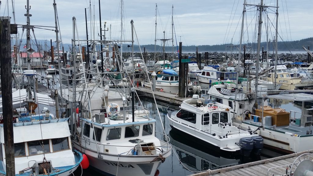
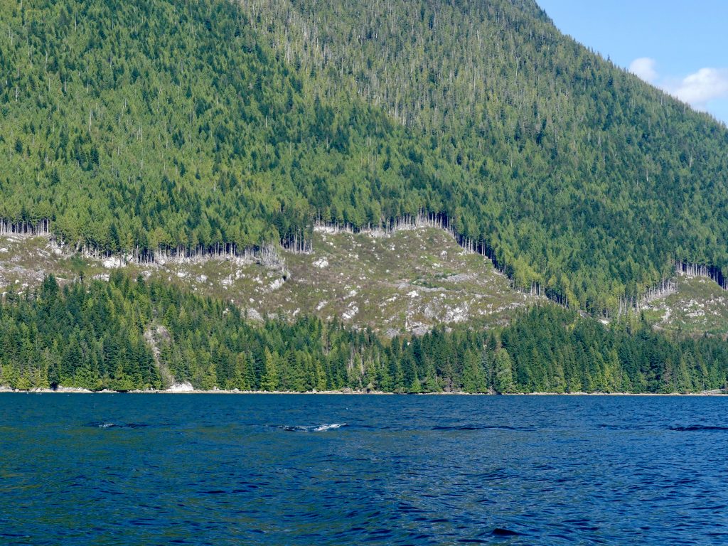
Salmon trollers, tied at the dock, Campbell River (Harvey Hochstetter)
The salmon trolling fleet in this pretty town has been tied up at the dock all summer. Not enough fish for commercial openings, and no one can say exactly why. It could be the massive landslide that closed the Fraser River to fish passage earlier this year. Some say it could be Japanese drift-net fishing once again interdicting returning salmon. Or it could be the things people like Billy Proctor and Alexandra Morton have been warning us about—fish farming, logging, mining, industrial-scale application of pesticides, fertilizer runoff, loss of habitat, culverts and dams obstructing salmon migration routes.
All of these things are within our power to change. As the old Pete Seeger song goes, “I swear it’s not too late.”