Posts by andy
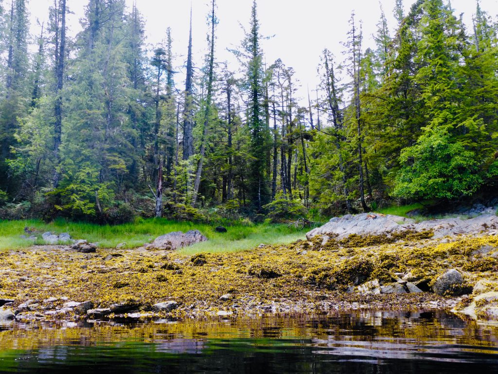
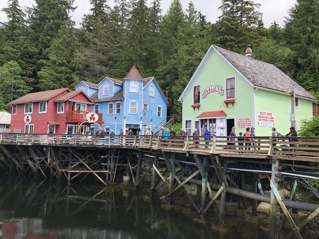
Rocky Pass and Point Baker
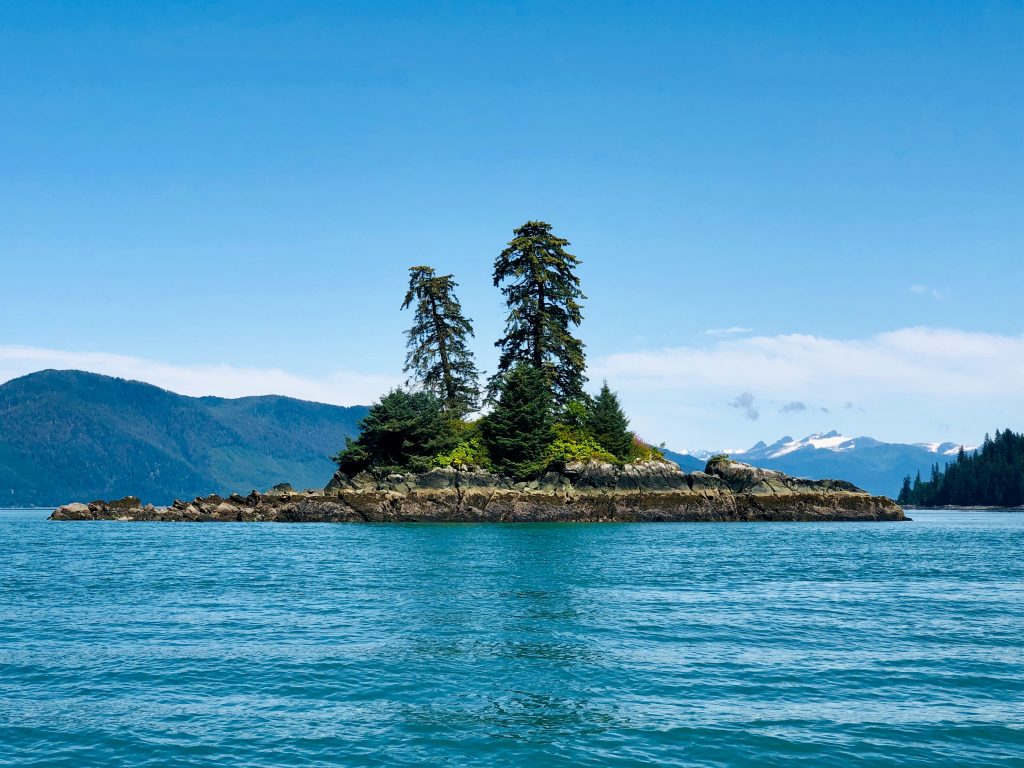
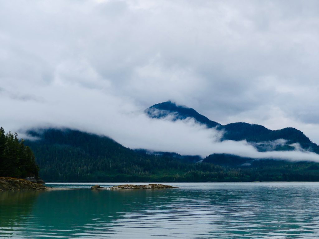
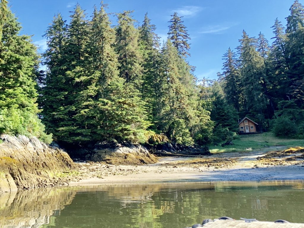
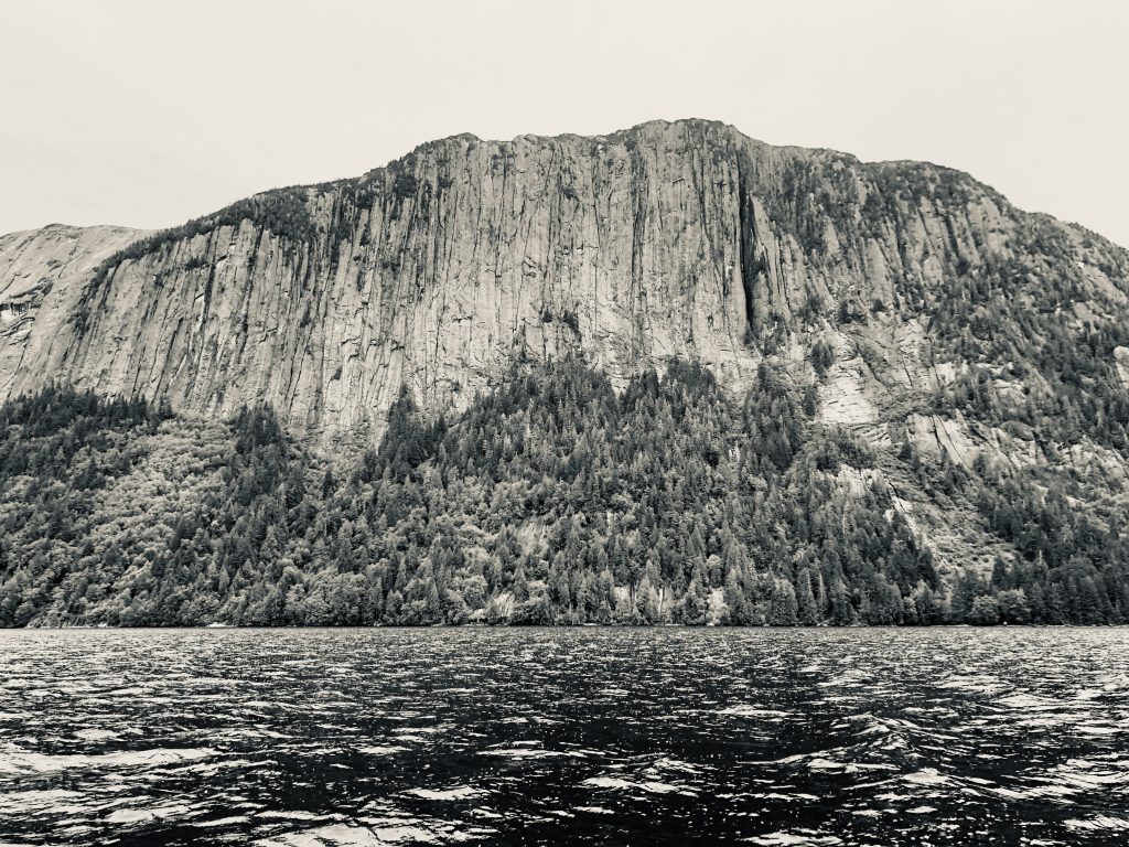
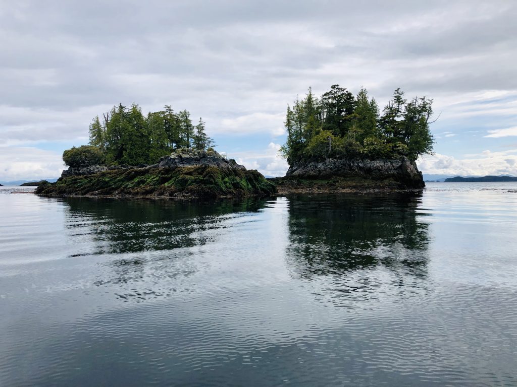
Two Trees Island, near Wrangell
IN HIS EPIC BOOK SAILING ALONE AROUND THE WORLD, Joshua Slocum recounts “the greatest sea adventure of my life” — finding himself at night in “the Milky Way of the sea,” northwest of Cape Horn, amidst huge breakers over sunken rocks in every direction.
“What a panorama was before me and all around,” wrote the world’s first solo circumnavigator. “What could I do but fill away among the breakers and find a channel between them … God knows how my vessel escaped.”
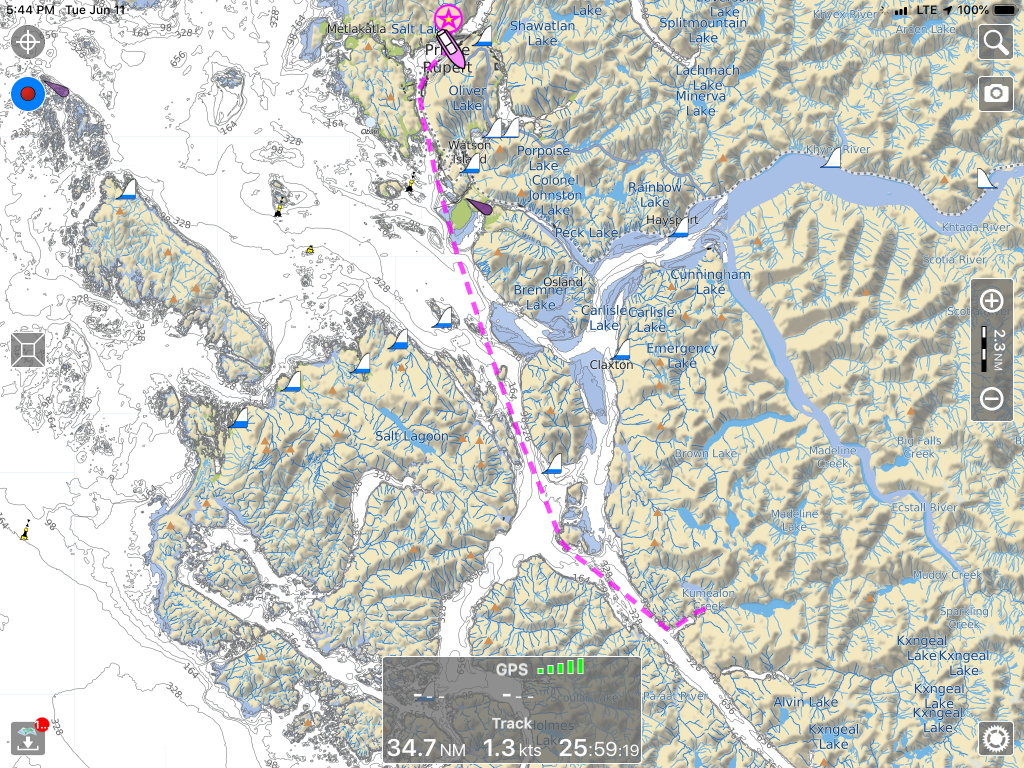
I was reminded of Slocum’s Milky Way when I looked at the chart of Rocky Pass, a twisty, rocky, shallow passage separating Kupreanof and Kuiu Islands. My first thought was, “Let’s not go that way.”

A section of Rocky Pass (the asterisks are rocks)
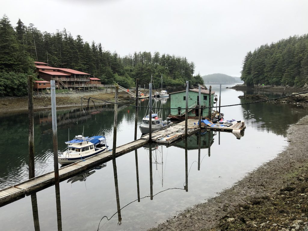
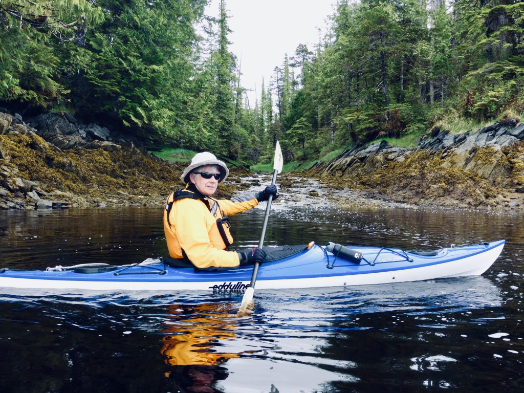
But despite its somewhat fearsome reputation, Rocky Pass was an easy passage for nimble, shallow-draft Osprey. Against all online, crowd-sourced advice, we went through the pass from the north at low tide, making easy headway against a strong northbound current. Weaving around thick mats of kelp was the greatest challenge; and at one point I had to raise one of the motors to remove kelp from the cooling water intake.
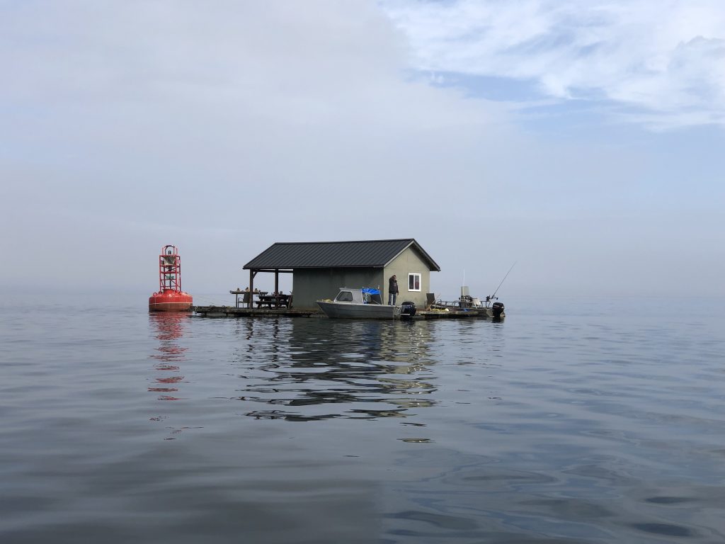
Emerging from Rocky Pass, we headed south across wide Sumner Strait, to the hamlet of Point Baker, population, 25, on the northwest tip of Prince of Wales Island. Point Baker is said to be home to Alaska’s last floating tavern, so of course we had to visit.
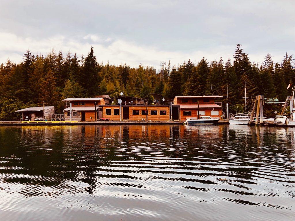
Floating Point Baker Trading Post store and bar

Osprey at Point Baker Trading Post

Sisters Juli Bowes and Annette Hoyt behind the bar at the floating Point Baker Trading Post
Juli and Annette’s dad, Herb Hoyt, bought the place back in the 80s. Juli was working the bar, while Annette—who went to culinary school—was back in the kitchen, fixing some of the yummiest burgers we’ve sunk our teeth into.
Juli spends her winters in Lake Havasu; and when the Trading Post closes for the season, Annette heads back to the Raymond, Wash. area, where she hunts Roosevelt elk.
Seated next to Dave Ortland and me at the bar were brothers Jim and Dave Engel from Saugatuck, Mich., who were up here with their wives, salmon fishing. Dave Engel is a charter fishing guide back home, and when the local bait of choice—herring—failed to do the trick, he switched to Michigan-made lures. Result: a handsome pair of king salmon.
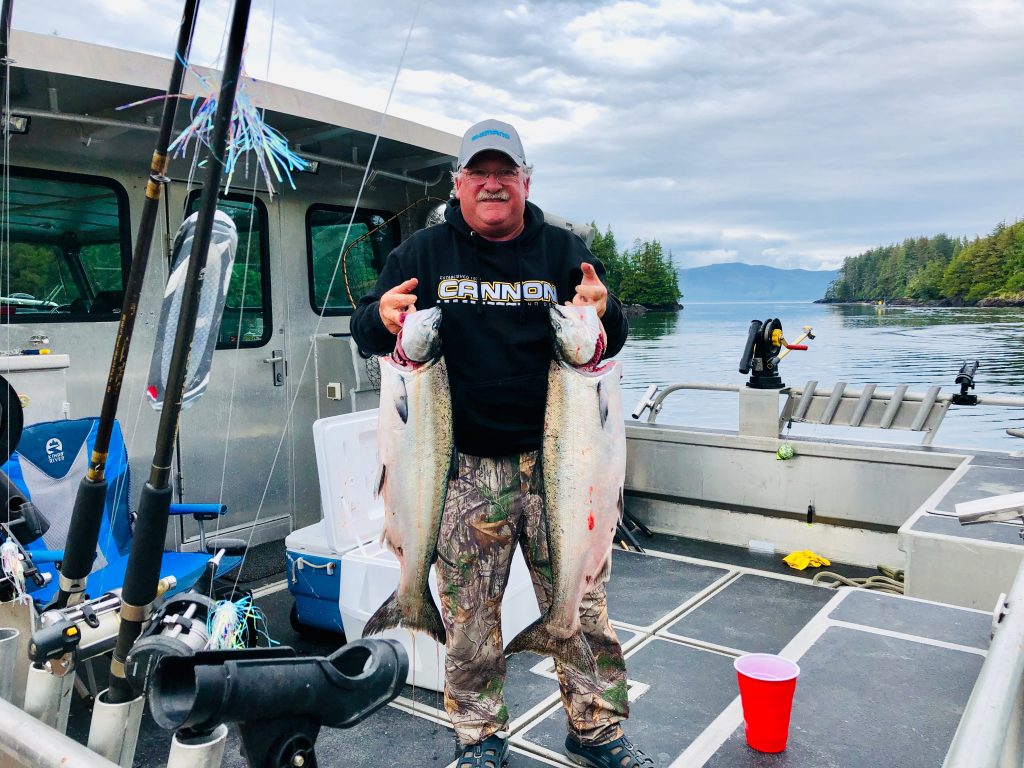
Dave Engle with a pair of kings, caught the Michigan way
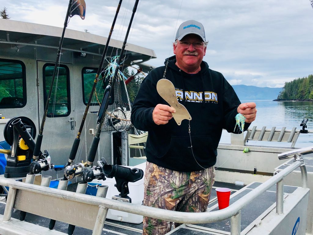
Dave Engle with the tools of his trade
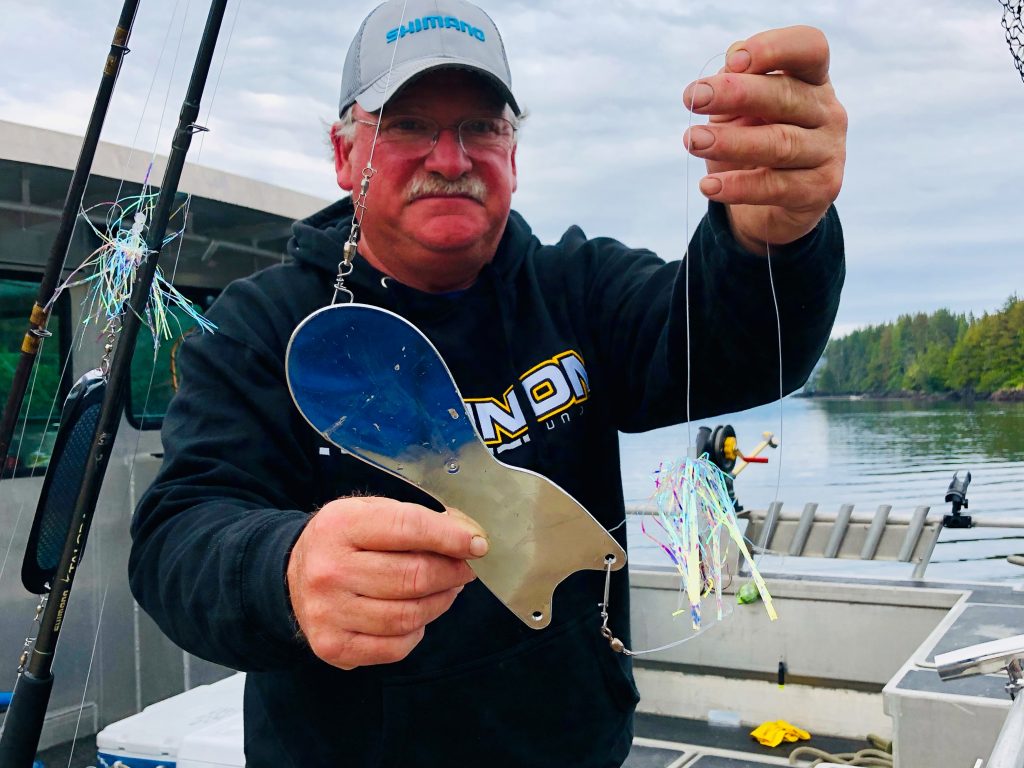
Michigan-made Spin Doctor mirage (a color) Strong Flies
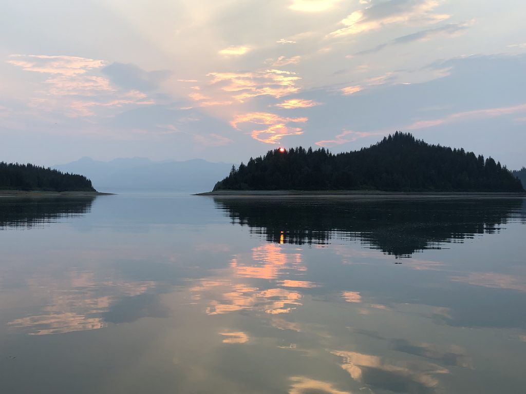
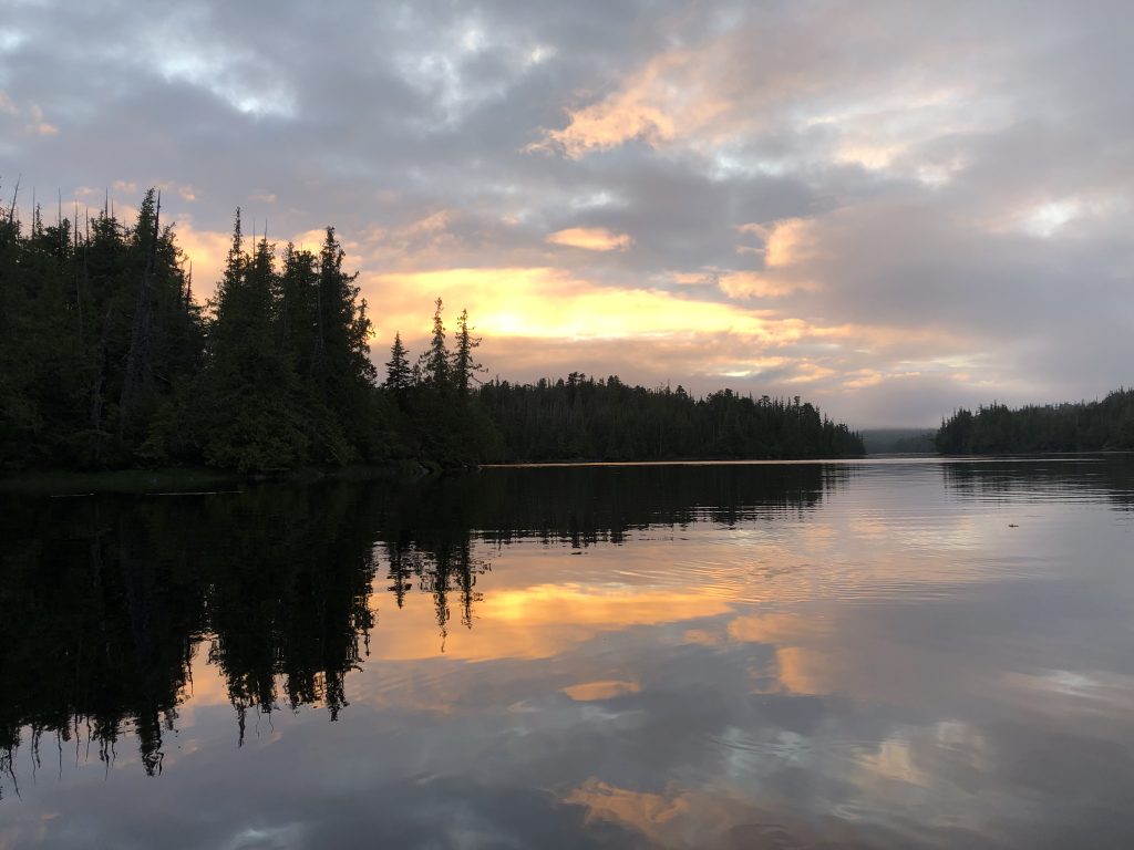
From Point Baker, we motored back across Sumner Strait, to an anchorage in Totem Bay—and a glorious sunset.
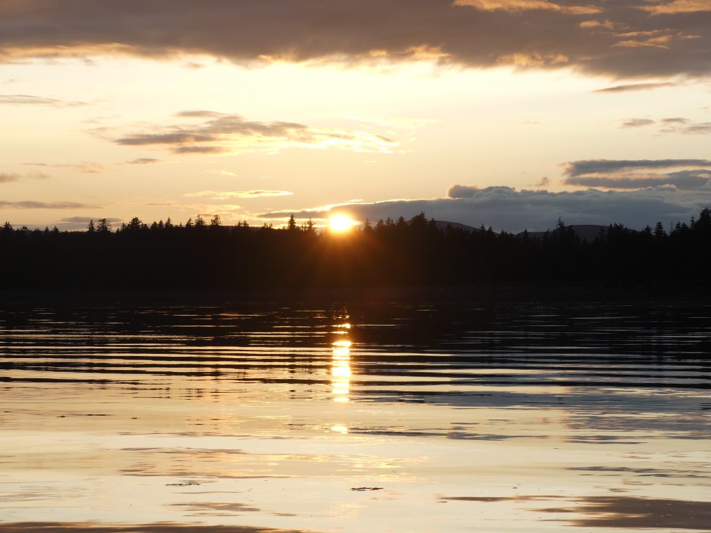
Sunset at Totem Bay
Along the way we saw:
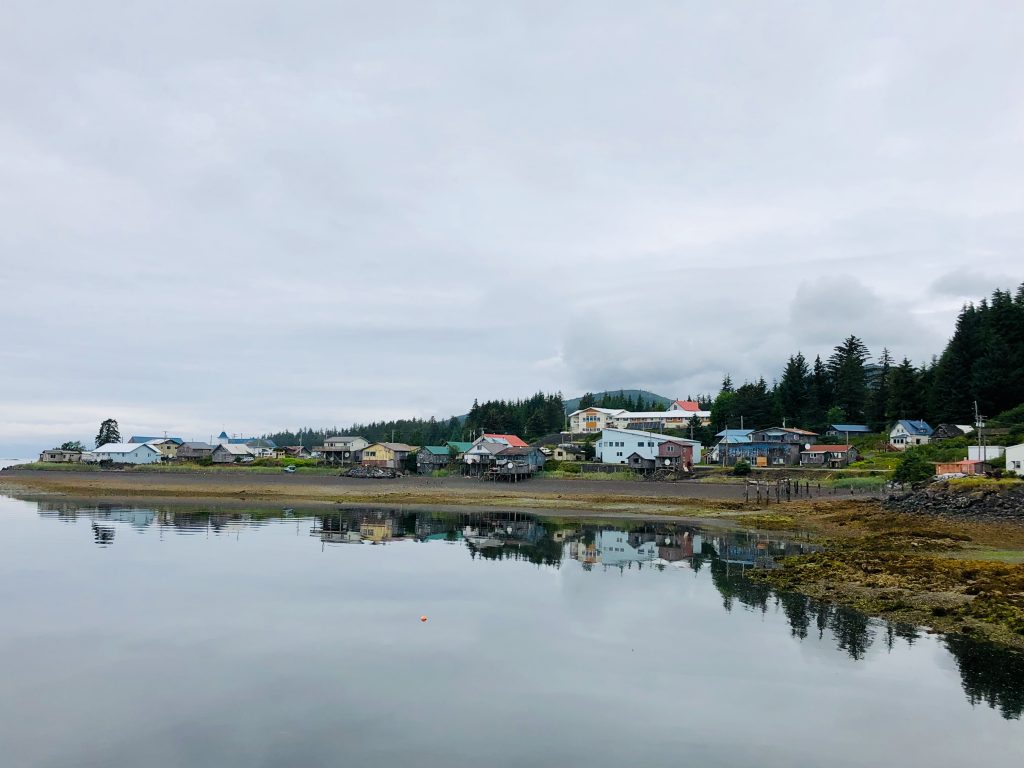
Kake, a quiet Tlingit village, population 710, on the west side of Kupreanof Island
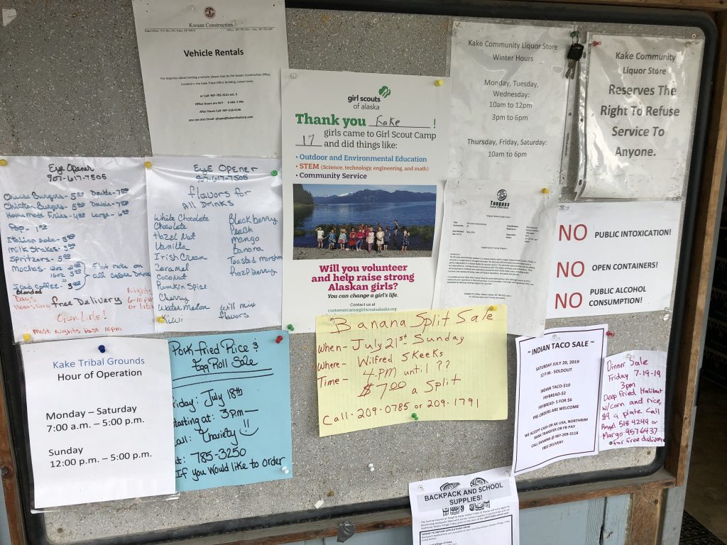
Community bulletin board at Kake
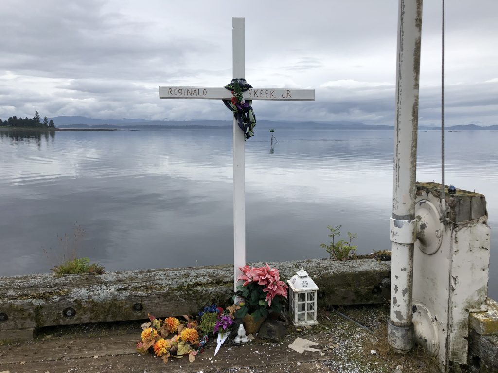
Memorial on public dock at Kake
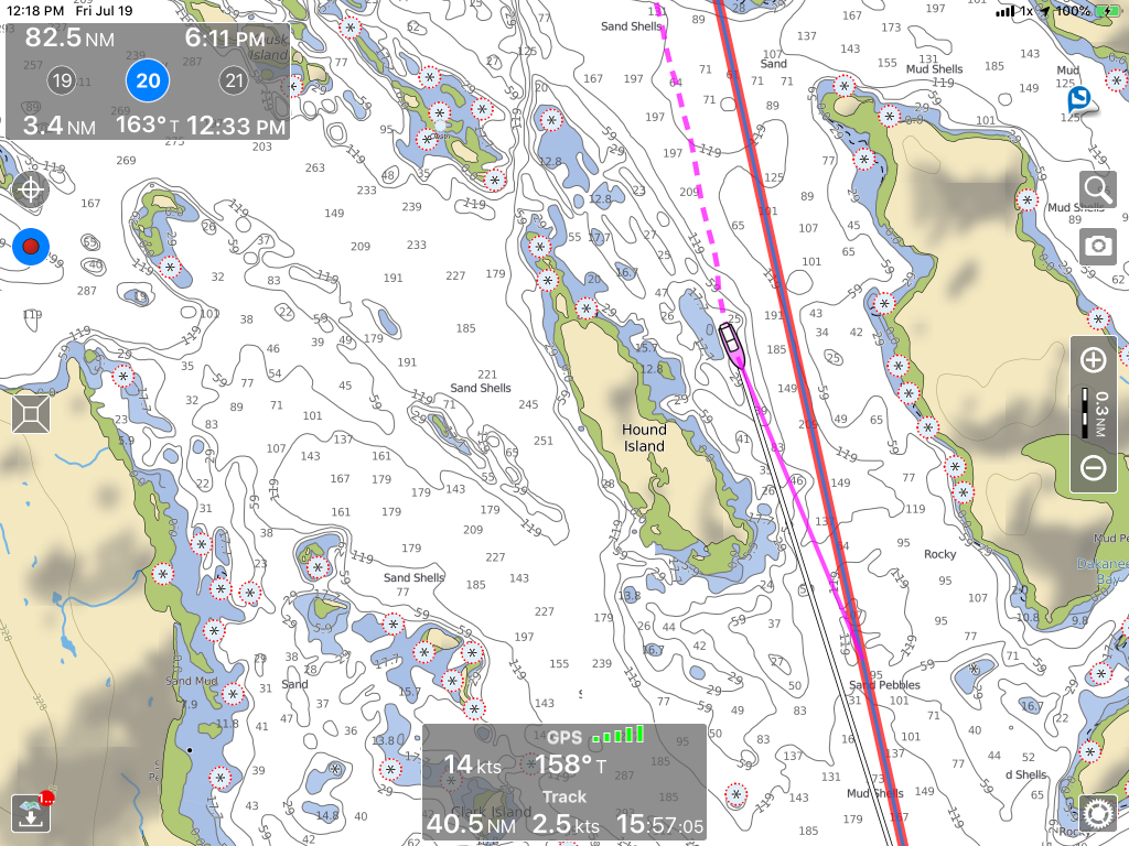
Hound Island
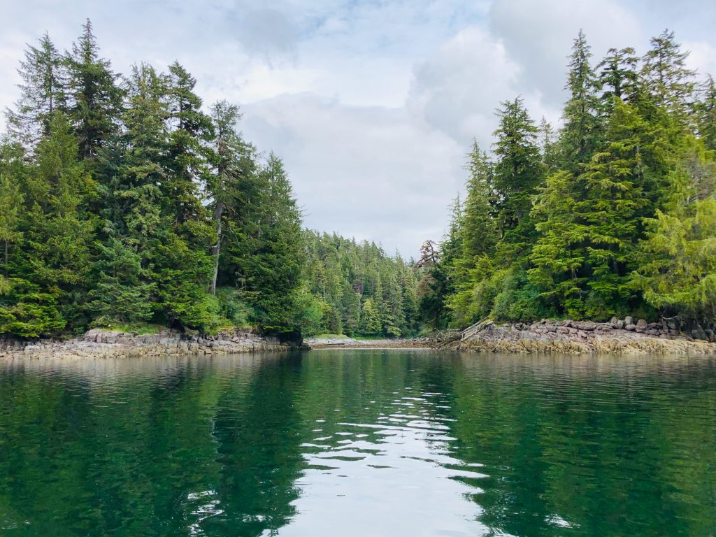
Secluded anchorage in Port Camden
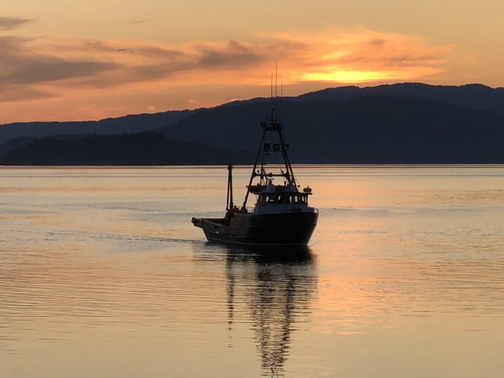
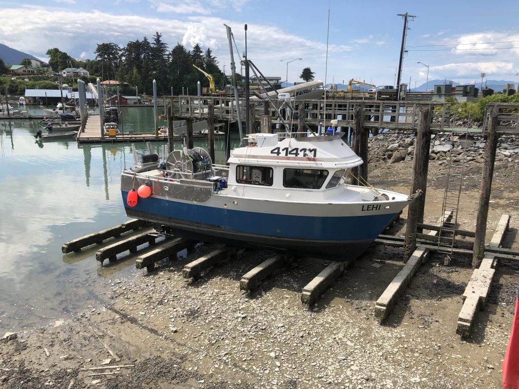
Fishing boat entering Wrangell Harbor
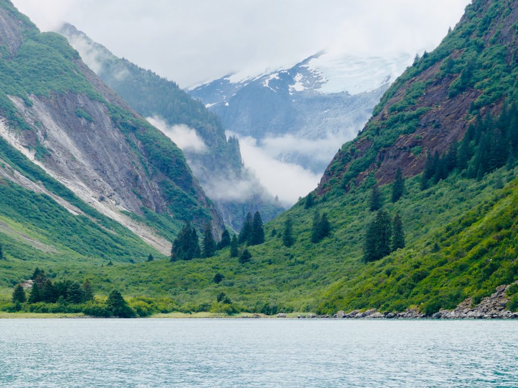
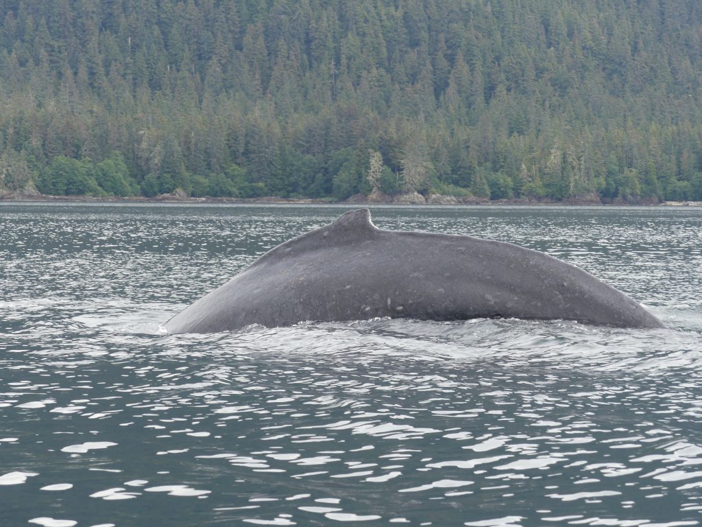
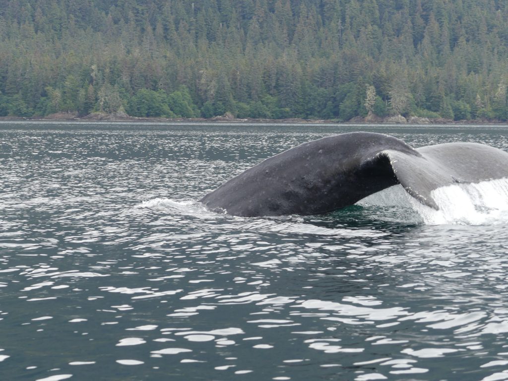
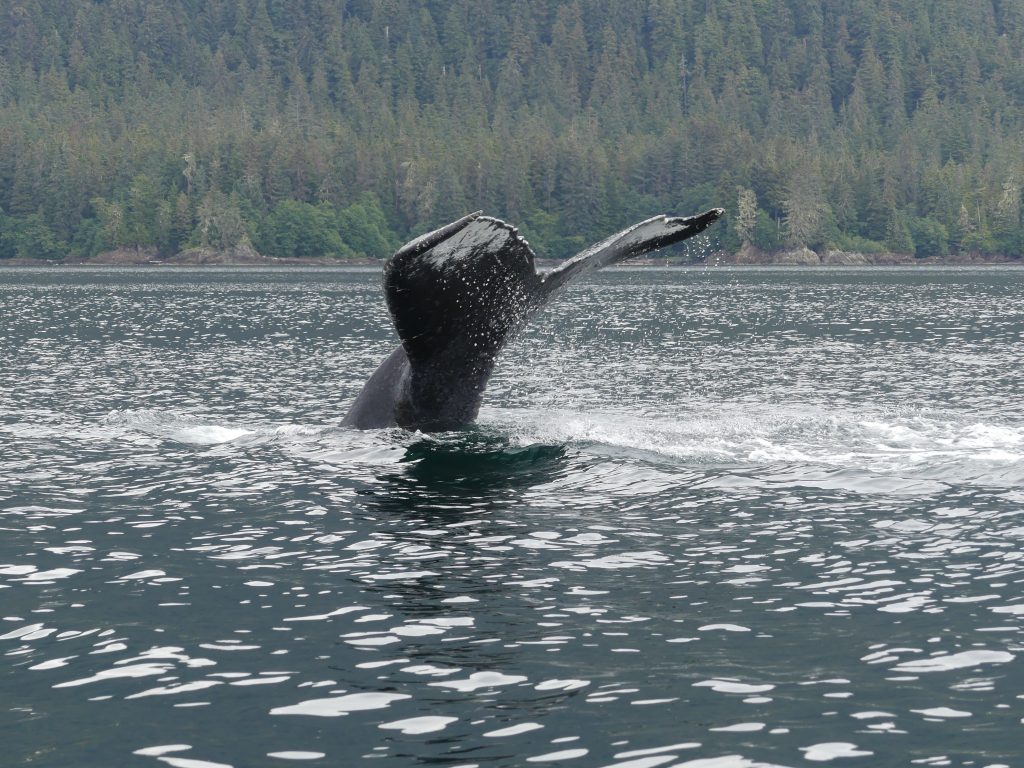
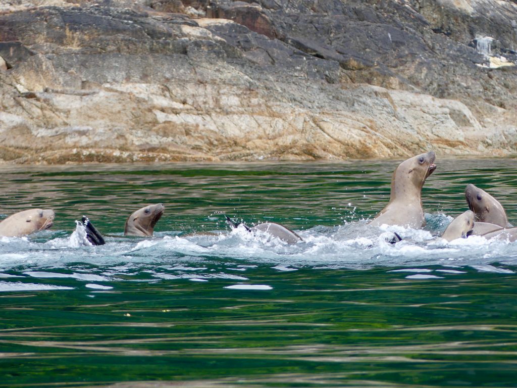
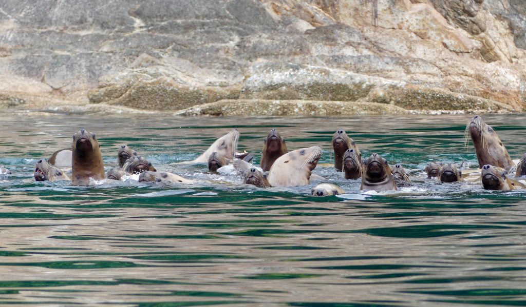
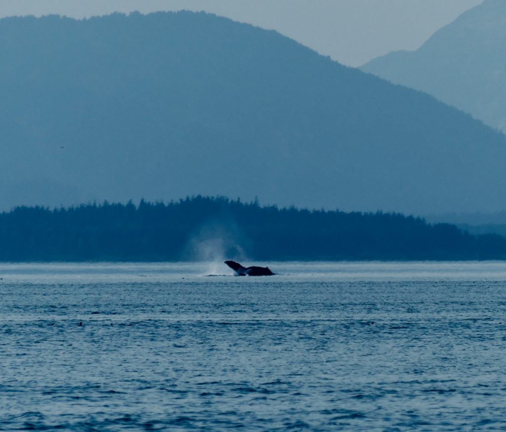
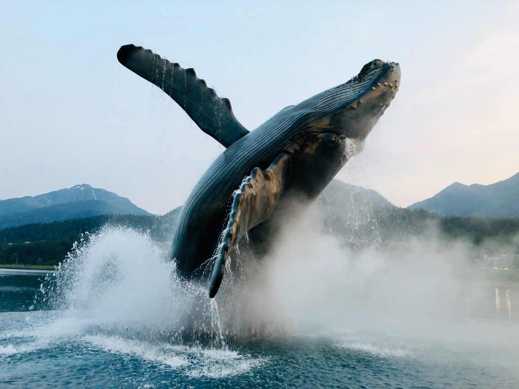
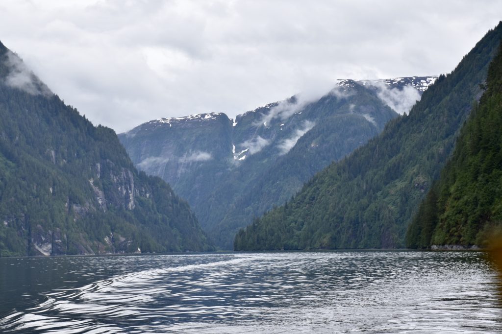
Tracy Arm, whales and sea lions
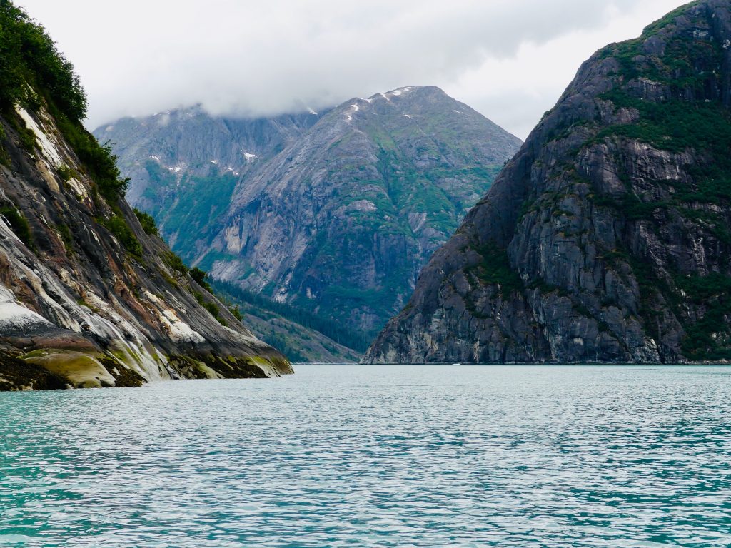
Tracy Arm passage
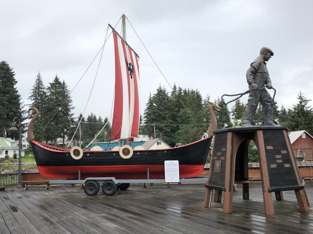
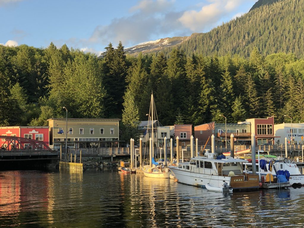
WE WERE ENTERTAINED LAVISHLY last night at the home of Rocky and Sue Flint, whose new home has a spectacular 180-degree view of Frederick Sound. After dinner Sue’s sister, former Petersburg First Lady (FFL) Sally Dwyer drove us around this friendly, hard-working burg.
Sally has deep roots in this community, which takes tremendous pride in its Norse heritage. Her grandfather ran a cannery here, with a fleet of fishing boats, and was, among other things, the town’s mayor. Her dad was a commercial fisherman, and her late husband Al was also mayor.
I wish we could stay here for a month, but Dave has a plane to catch, in Ketchikan in a few days, so we’re off in a couple of hours. Next stop Kake and the west side of Kupreanof Island, with a passage of twisty, Rocky Pass, which—as the chart shows—more than lives up to its name.
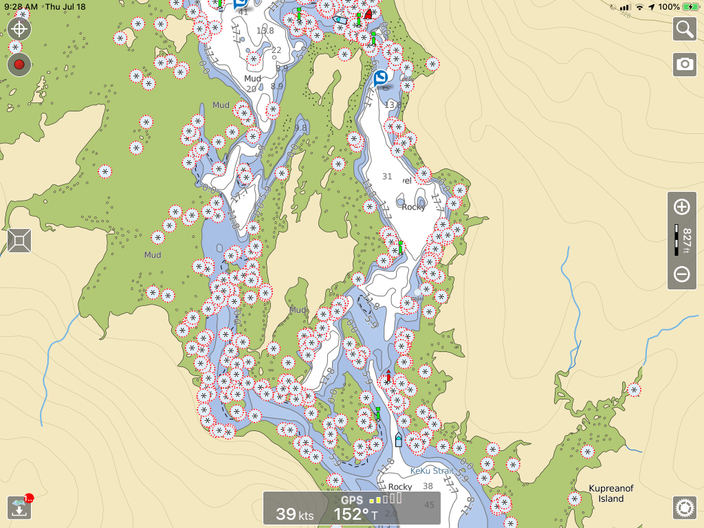
Portion of Rocky Pass
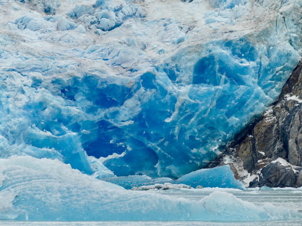
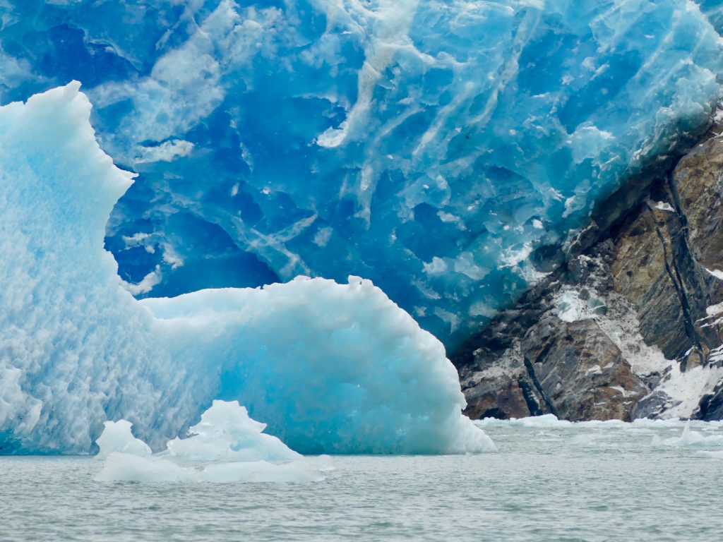
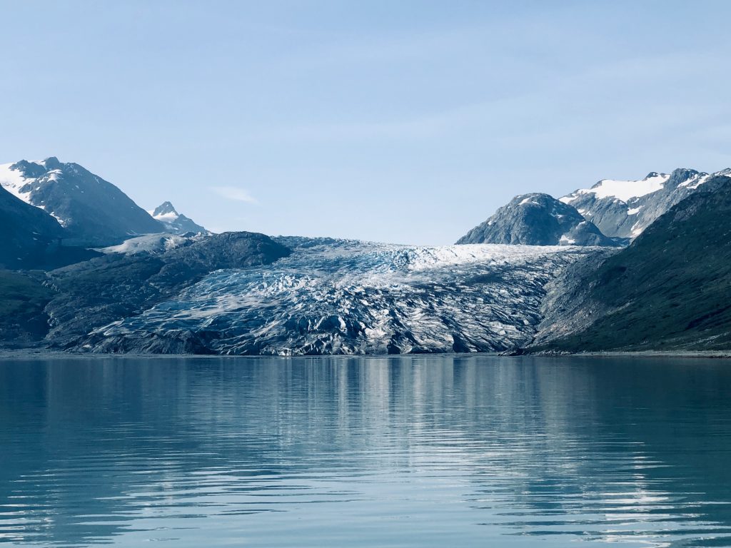
Here’s a photo gallery of the sights we’ve seen since my last post, starting with our visit to Tracy Arm and the South Sawyer Glacier:
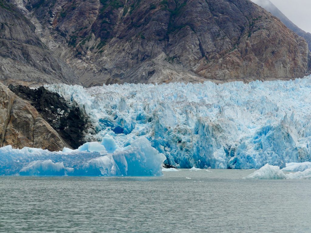
South Sawyer Glacier

Whales, between Point Hobart and Five Fingers Light
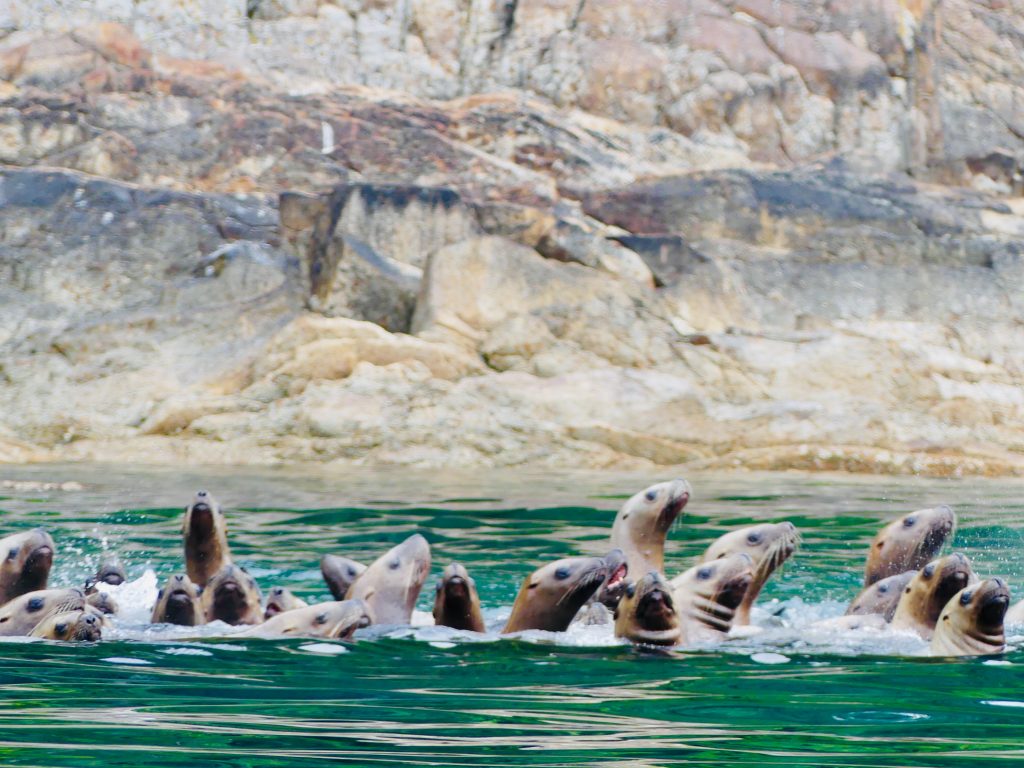
Sea lions at Sunset Island
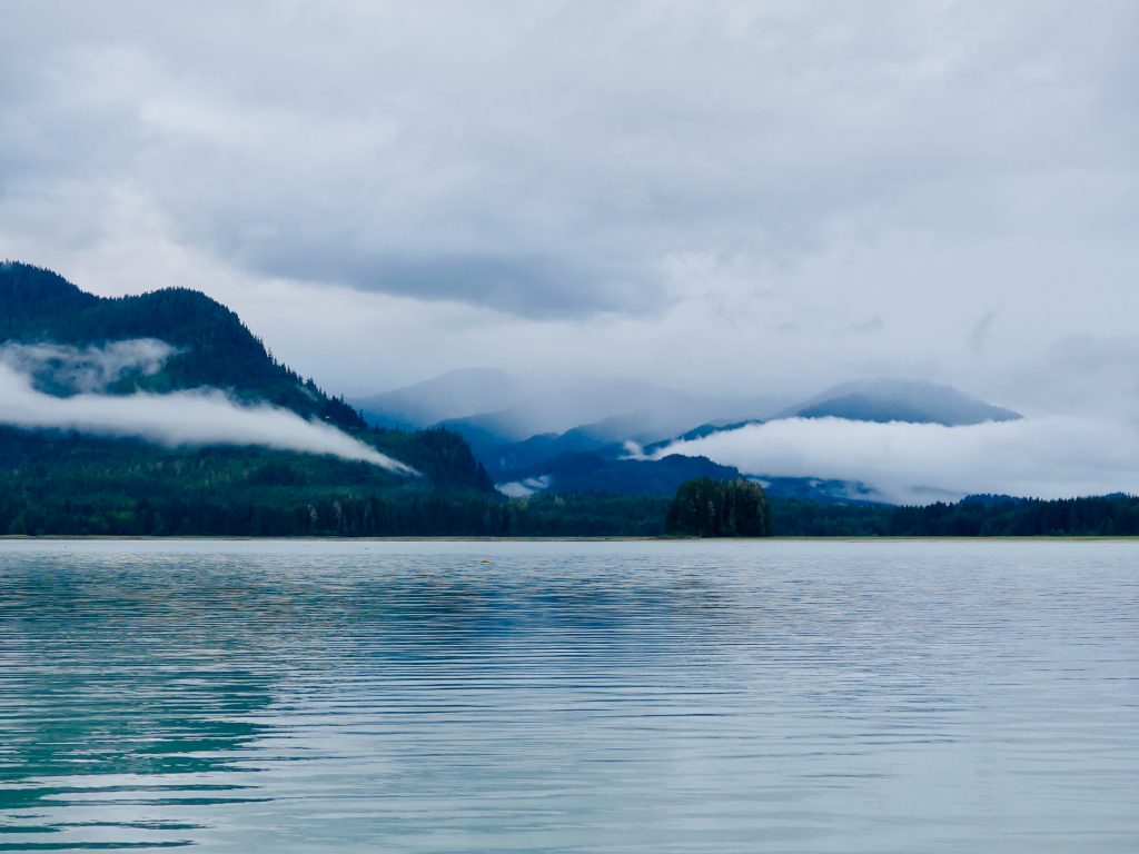
Thomas Bay


Dave Ortland prepares Thai dinner

Dave texting in Thomas Bay

Petersburg
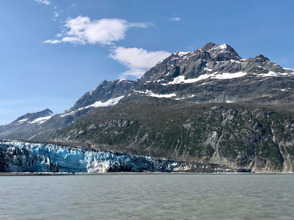
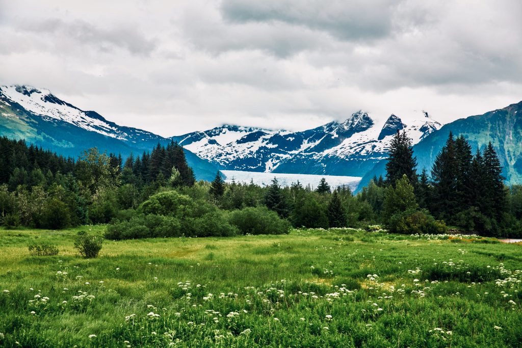
Glacier Bay and environs
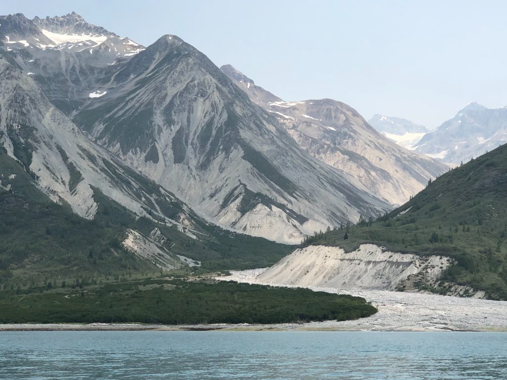
Glacial valley in Tarr Inlet, Glacier Bay
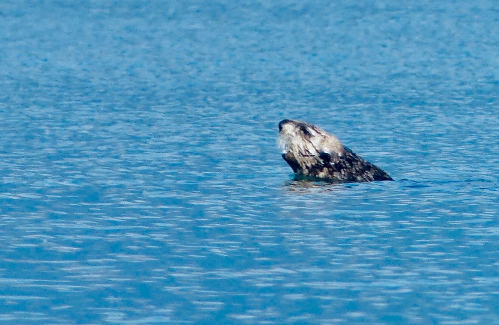
GLACIER BAY WAS FILLED WITH SMOKE from dozens of forest fires in the Yukon Territory and interior Alaska, and the sun was a weird shade of orange for much of the time we were in the national park.
And It really didn’t matter. We were too busy watching beautiful things—whales, sea otters, bears and glaciers—to think about the dramatic environmental changes washing over our planet. We’ll get back to worrying about that when we get home.
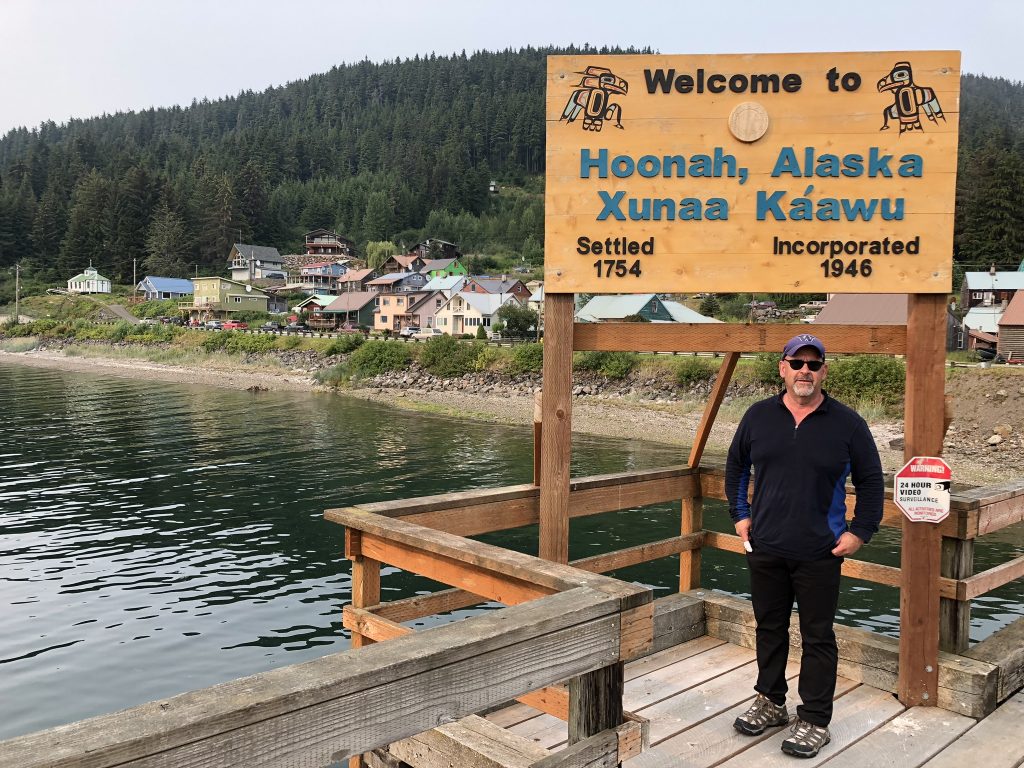
Kinnon and I are back in Juneau now after traveling over 300 miles in eight days—to St. James Bay, Couverden Bay, Hoonah, Glacier Bay, Dundas Bay and Elfin Cove. Kinnon flies out tomorrow, I’ll pick up my fourth passenger, Dave Ortland, at the Juneau airport at 9 a.m. And then we’ll be off for the glaciers of Tracy Arm.
I’ll post more words and photos when I get to Ketchikan, in about two weeks. But in the meantime, here’s a taste of what we’ve seen:

Glaciers
Glaciers
… and more glaciers
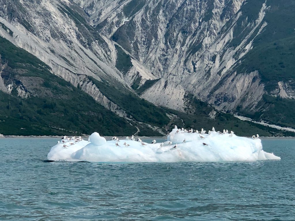
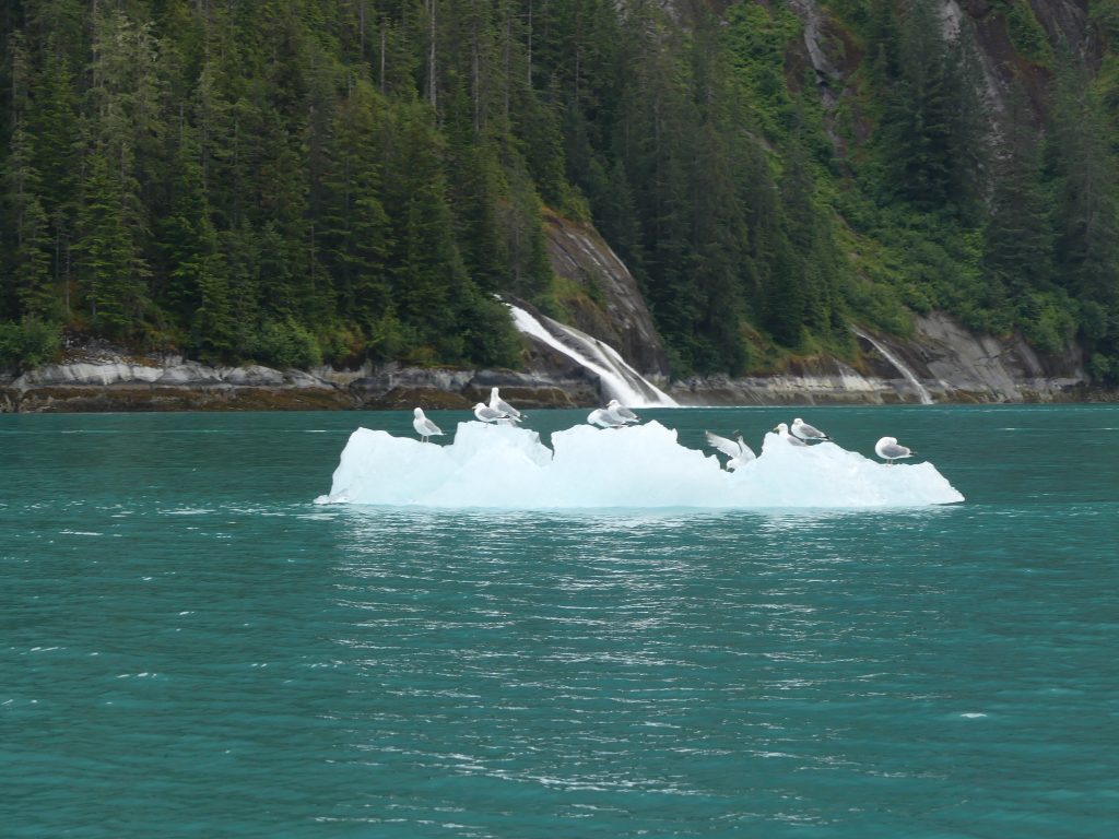
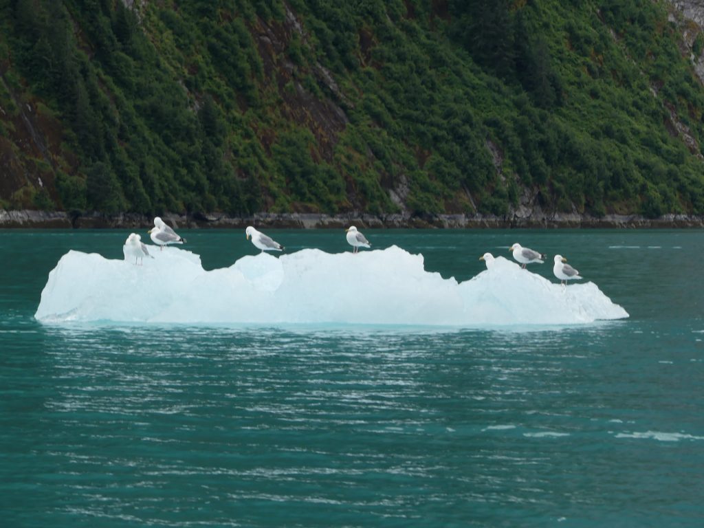
Gulls on ice flows
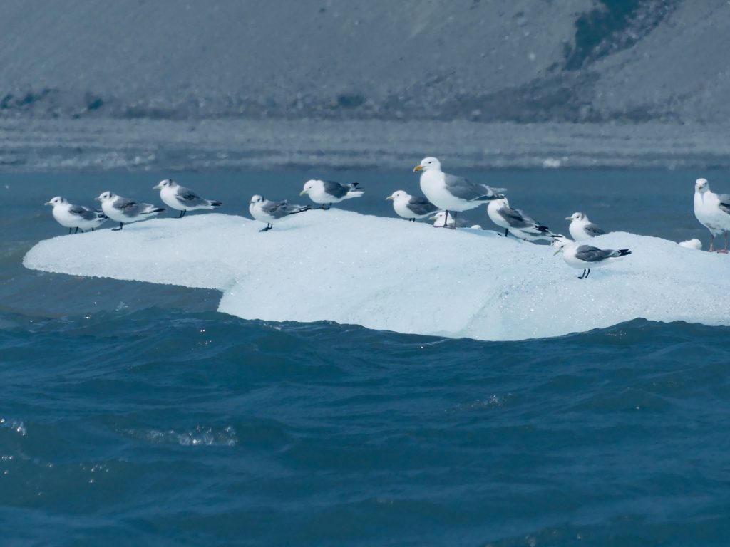
Ice flow gulls (Kinnon Williams)
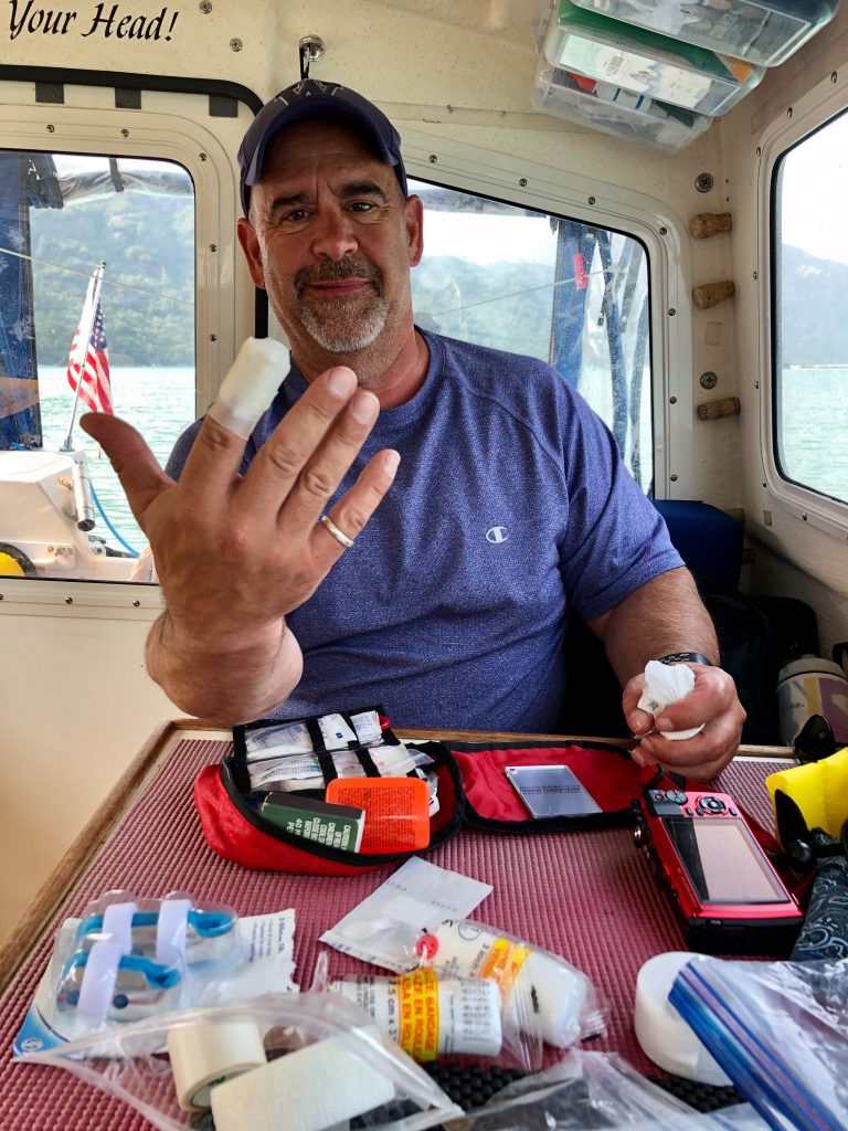
Kinnon came close to cutting off the end of his finger
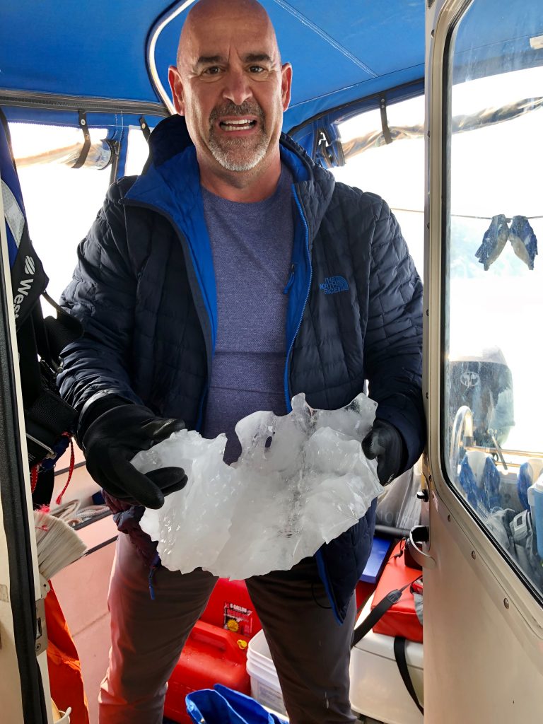
But it didn’t stop him from grabbing a small hunk of Glacier for our ice chest
Smoky sunset over Sandy Cove, Glacier Bay
Sea lion (Kinnon Williams)

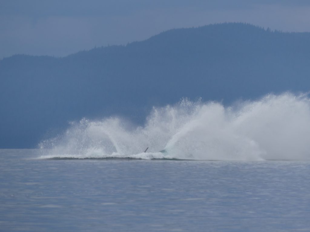
Humpback whales (Kinnon Williams)
Humpback whale (Kinnon Williams)

Sea otter, feasting (Kinnon Williams)
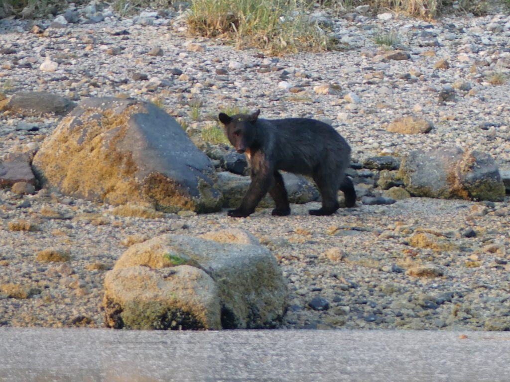
Black bear, Shag Cove
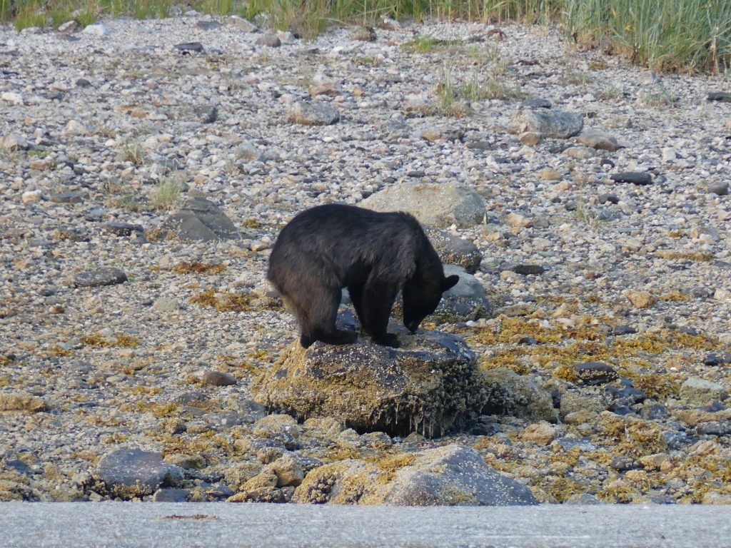
Shag Cove bear
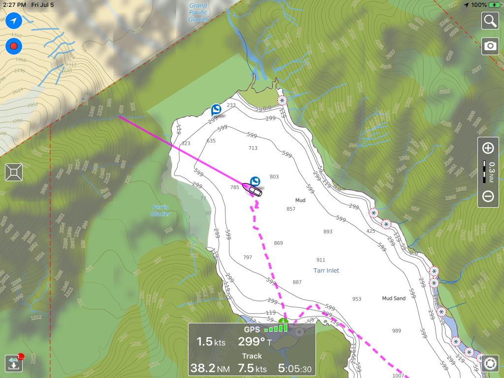
Northernmost point of our trip, in Tarr Inlet, just south of Canadian border
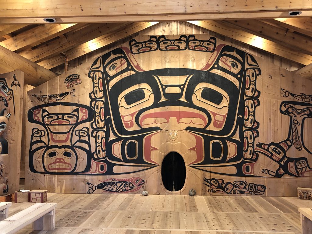
Carvings in Huna Tribal House, Bartlett Cove, Glacier Bay
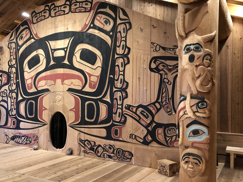
Huna Tribal House detail, Bartlett Cove, Glacier Bay
Huna Tribal House detail, Bartlett Cove, Glacier Bay
Huna Tribal House detail, Bartlett Cove, Glacier Bay
Village on a boardwalk: Elfin Cove

Elfin Cove general store
Elfin Cove intersection
Osprey at Elfin Cove
Kinnon at Hoonah
Hoonah, from the water
Alaska’s capital, Juneau
Near the end of Glacier Highway, Juneau
MY WIFE MARLA AND I MET AT A MURDER-SUICIDE in Anchorage, and a few months later we moved to Juneau. We were both reporters. Mar covered Alaska government for a statewide radio network; I wrote for the Anchorage Times. We moved to Miami in 1985 for work. That was almost 35 years ago, and I haven’t been back here since.
In the intervening years, The 49th state’s capital city has grown by about a third (to 32,000 in 2014) and, in summer months, enormous cruise ships daily discharge thousands of tourists onto city streets. If you decide to visit, try and pick a time when one or more of the 5,000-passenger megaships isn’t docked downtown.
Marla has flown here with her brother, Kinnon, who will be traveling with me to Glacier Bay and back. My brother Bill is heading back to New York City. The infestation of cruise ships not withstanding, I still love this special town, which can only be reached by boat or plane.

Our old neighborhood (Marla Williams)
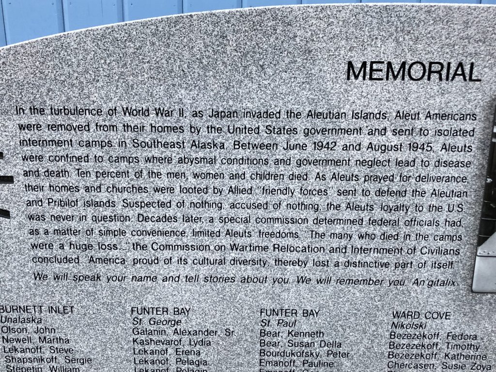
In 2016 the Aleutian Pribilof Islands Restitution Trust and the Aleutian Pribilof Heritage Group placed a memorial at the St. Nicholas Russian Orthodox Church, to the Unagan people who were forcibly removed from their homes during World War II and sent to internment camps in Southeast Alaska. Marla was privileged to write the words for the memorial.
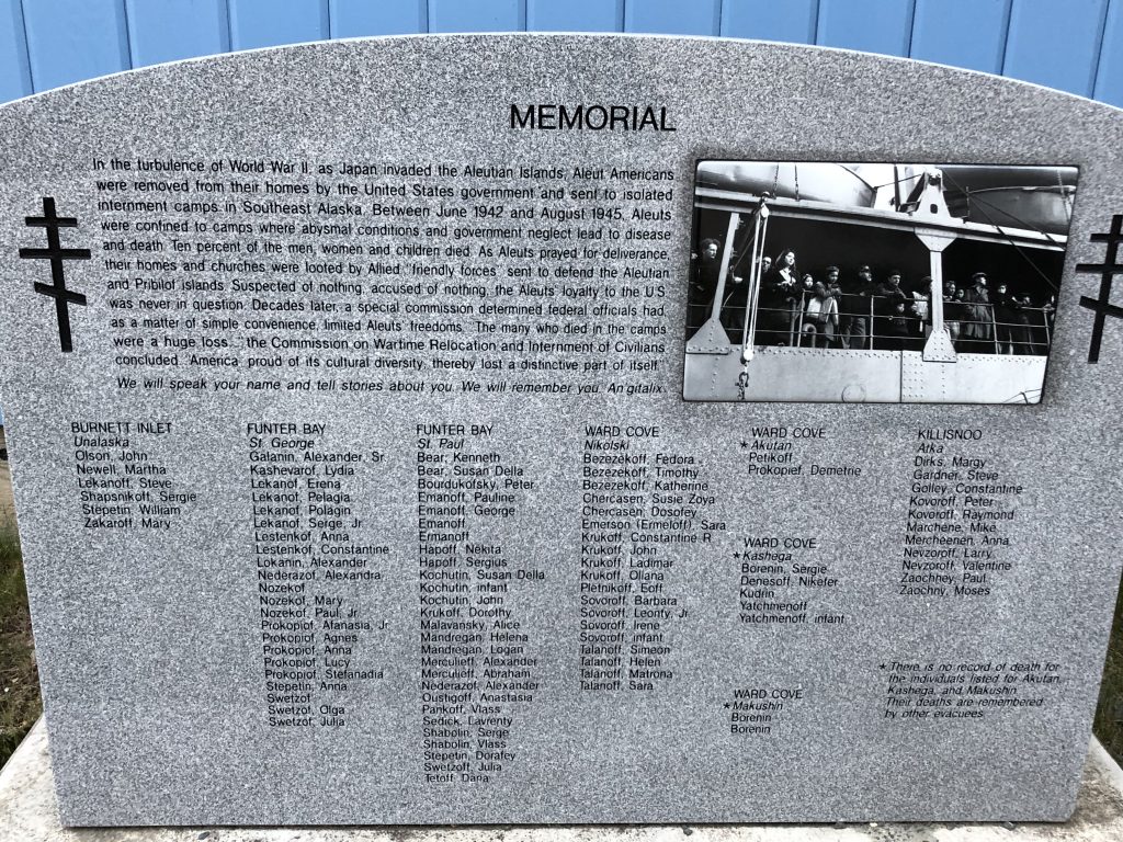
Memorial stone at St. Nicholas Russian Orthodox Church
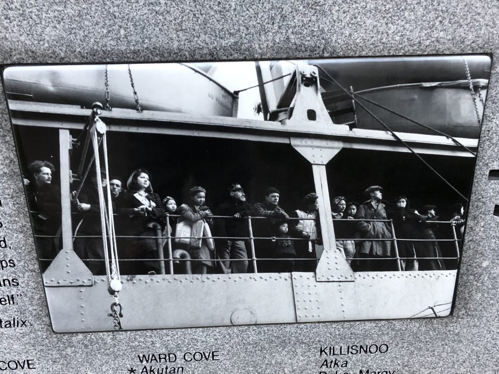
Detail from the memorial stone
Detail from the memorial stone
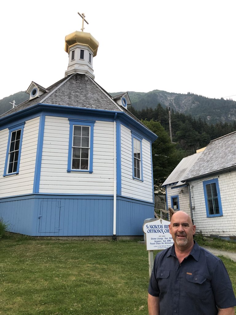
Osprey crew member Kinnon Williams at St. Nicholas Church
In Juneau we saw:
Humpback whale sculpture by local artist R. T. “Skip” Wallen
Mendenhall Glacier view (Marla Williams)

Eagle River, north of Juneau
Wrangell and the boat next door
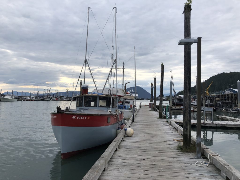
Hand troller Mij at Wrangell
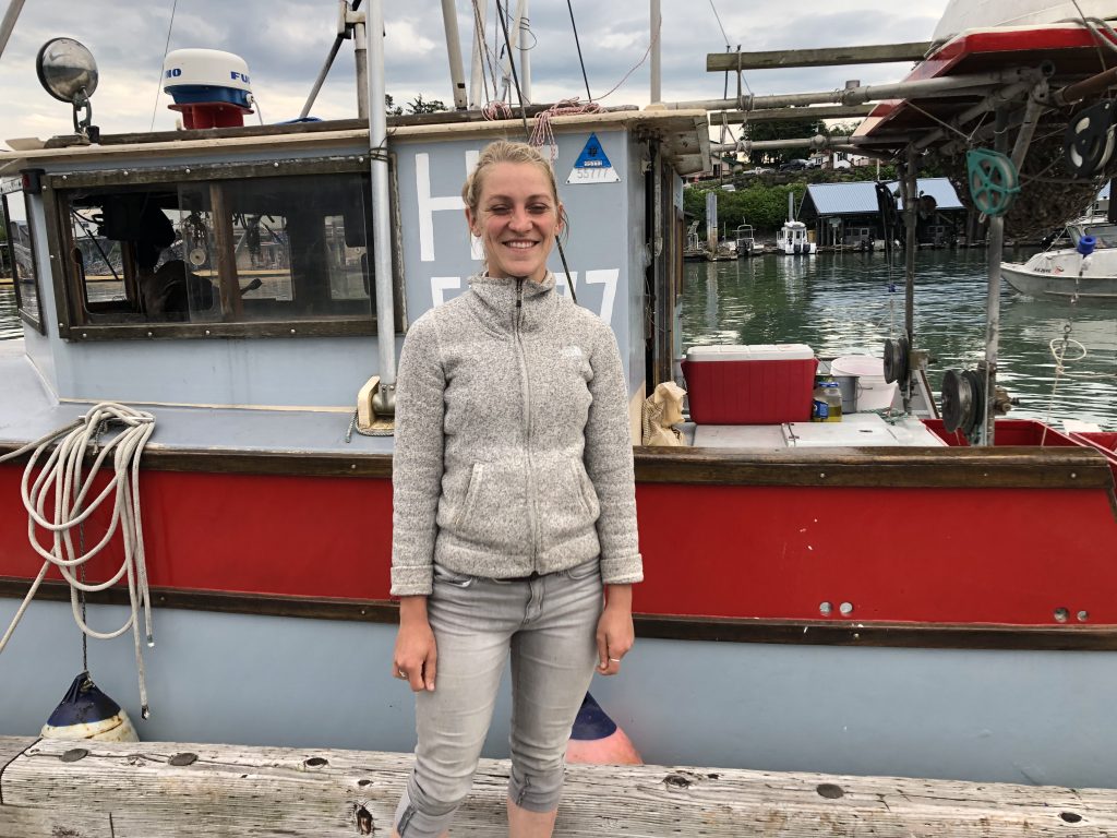
BEHIND US ON THE WRANGELL DOCK this afternoon was the 26-foot hand troller Mij. Her owner, 29-year-old Brittaney Schunzel was replacing a damaged rub rail.
Trollers pull long fishing lines behind them, attached to “troll poles”—outriggers—extending from either side of the boat. Power trollers, which pay more for their licenses, get to put out four lines and use mechanically powered reels to pull them in. Hand trollers are only allowed two lines, which they crank in by hand.
Trolling for salmon, by hand or power, is hard work. The fishing lines running from the troll poles are from nine to 28 fathoms long—a fathom is six feet—and shorter leaders with hooks at the ends are attached every nine feet. That’s as many as 36 lures on a hand troller, each of which may have hooked a salmon.
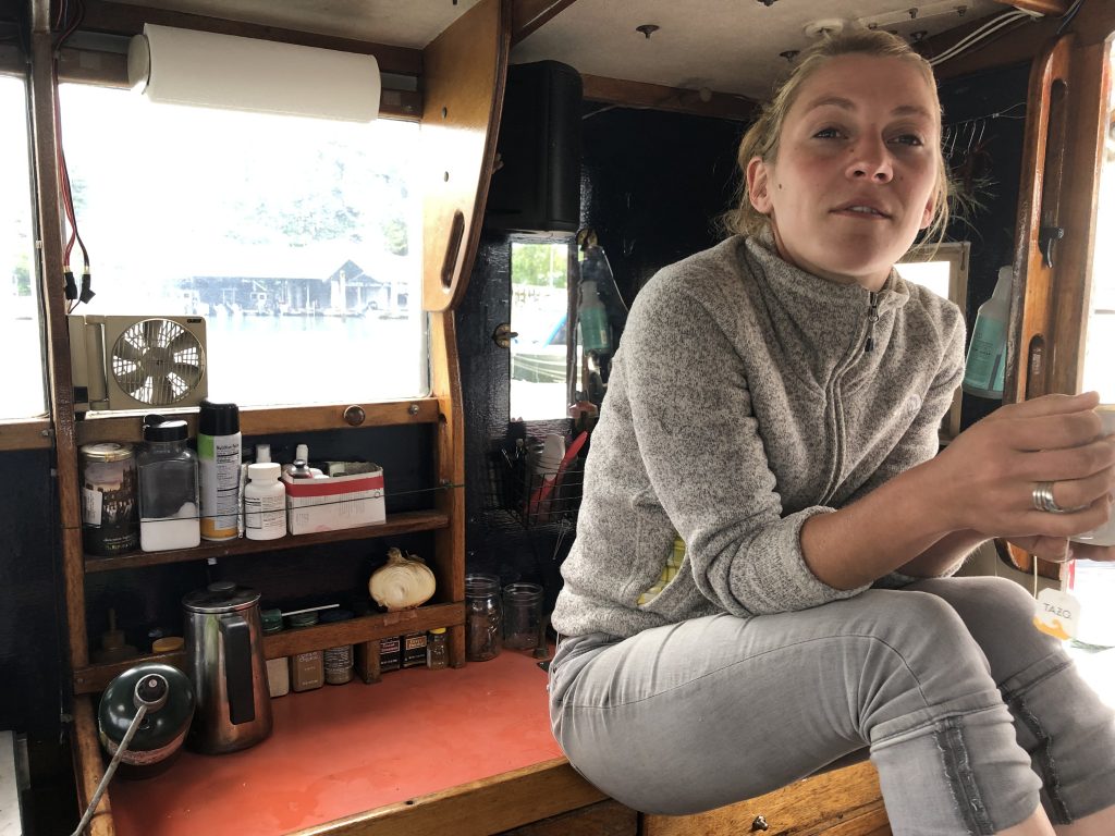
Skipper Schunzel in Mij’s galley
Brittaney shows lures for king and coho salmon
From July through mid-September Brittaney fishes for coho and king salmon, and she’s been making a living at it. Last year buyers were paying fishers $8.25 a pound for king salmon, and as much as $2.60 a pound for coho. She hopes this year’s prices will be as good as last’s; but this year her season will be cut short in August, when she’ll fly up to Anchorage to begin nursing school.
Will Brittaney be able to combine nursing and fishing? She hopes so. She loves her cozy, immaculate little boat and can’t even begin to think about selling her. Just maybe, she thinks, when school is done, she’ll be able to find nursing work in Wrangell, and live aboard Mij.
It makes me very happy to think Brittaney might be able to pull that off.
Brittaney and Mij
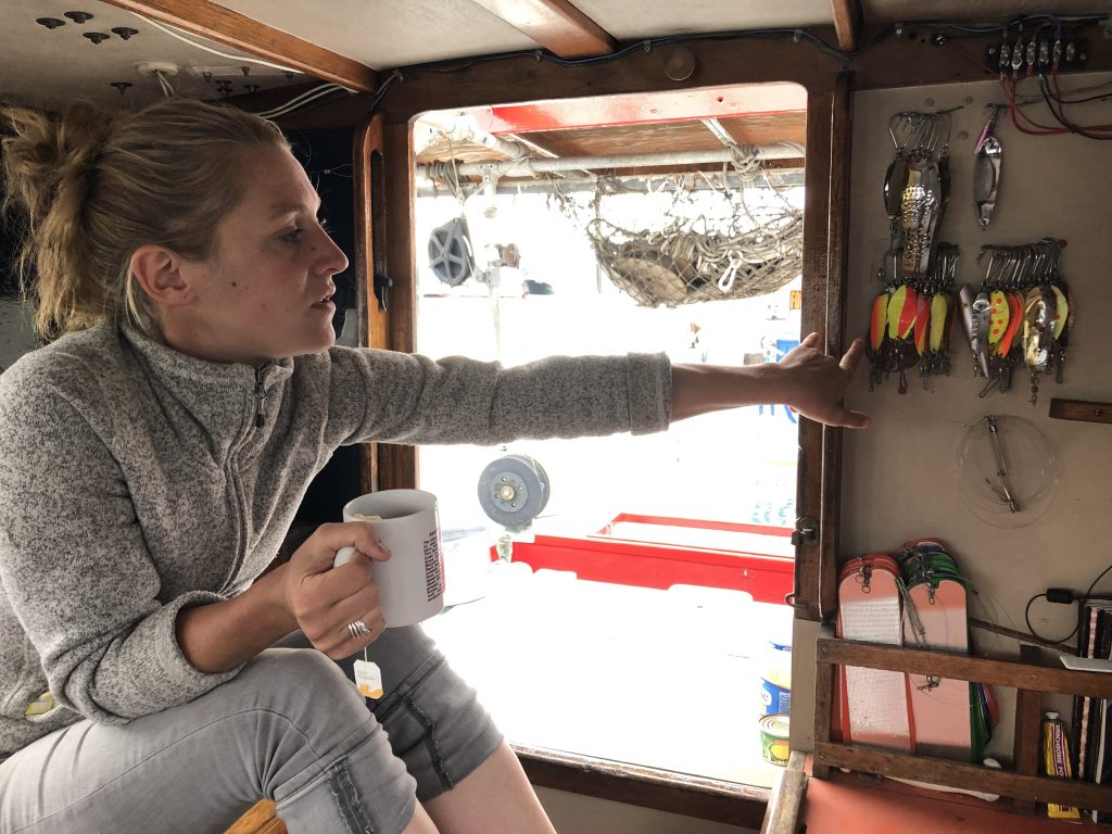
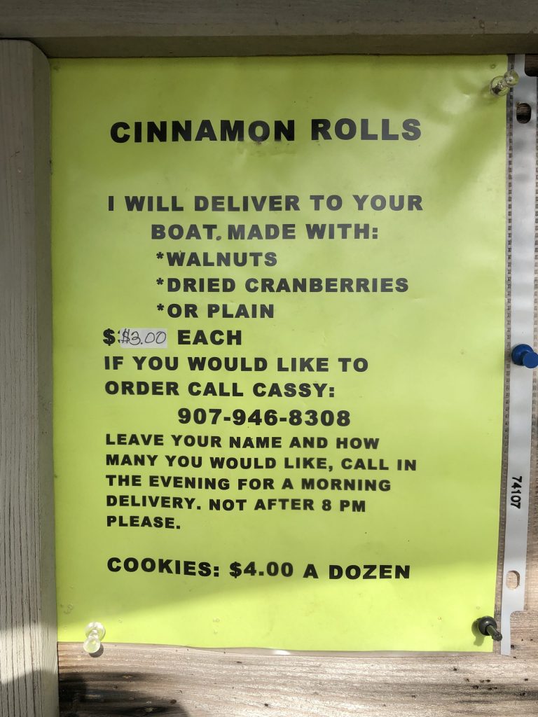
Since I last posted, Bill and I have motored from Knutson Cove to anchorages at Meyers Chuck (where longtime resident Cassy delivered her delicious homemade cinnamon rolls right to our boat), Thorne Bay and Anan Bay last night (where we saw our first brown bear.)
Along the way we have also seen:
Meyers Chuck’s most famous attraction
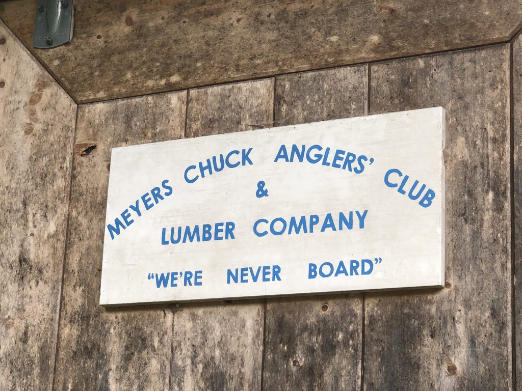
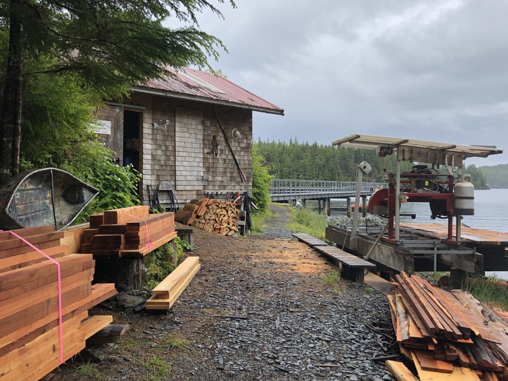
Small lumber mill at Meyers Chuck
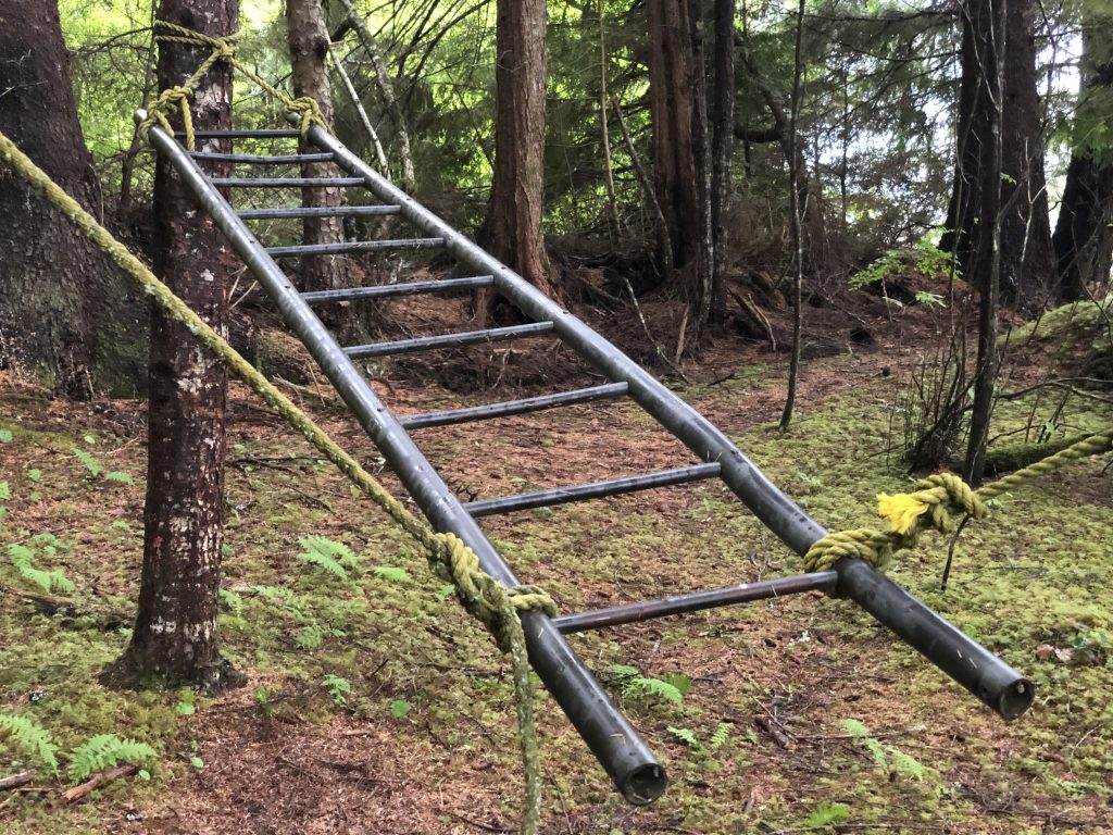
Playground apparatus at Meyers Chuck
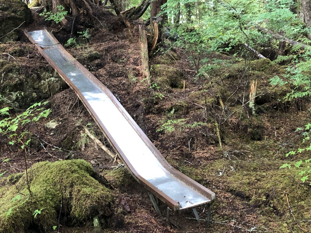
… and a slide

… and a teeter totter
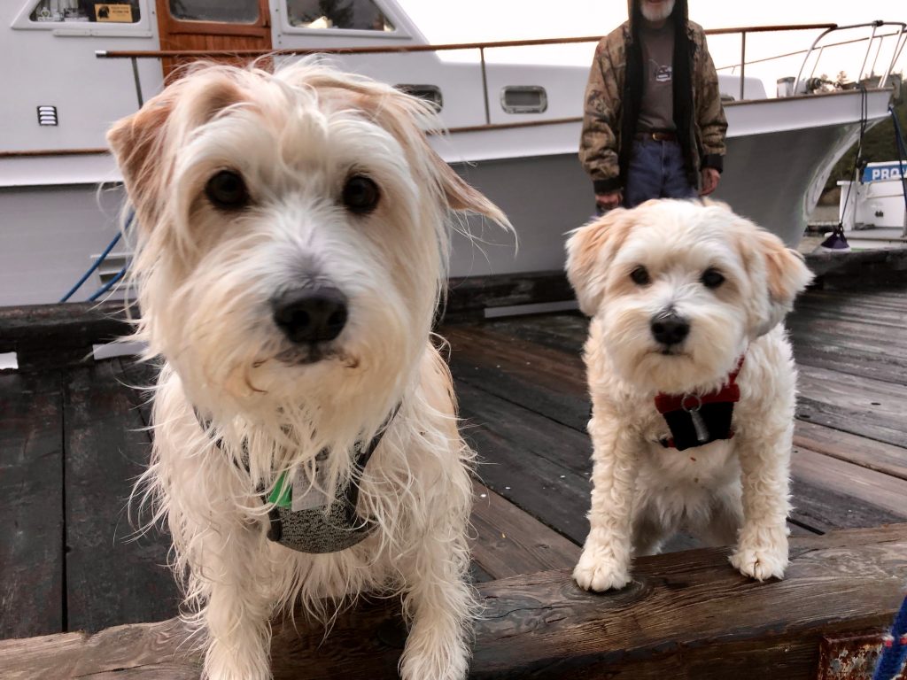
Visitors at the Meyers Chuck Dock

Andy selfie at Thorne Bay
Bill launching from the float at Anan Bay
Forest Service Cabin at Anan Bay (Bill Ryan)

Sunset at Anan Bay (Bill Ryan)

Morning view near Berg Bay (Bill Ryan)
Repairs on tidal grid, Wrangell
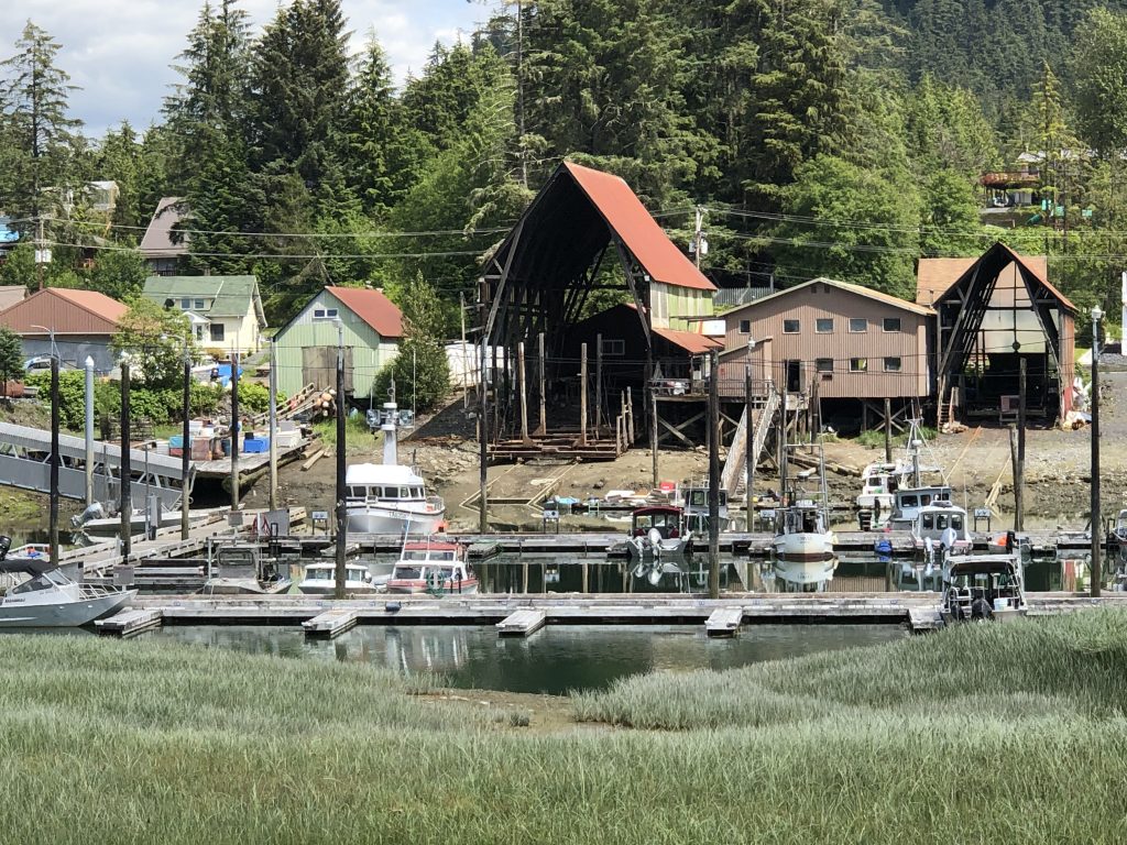
View across inner harbor, Wrangell
Misty Fiords passage
Granite cliff in Punchbowl Cove, Misty Fiords
BILL AND I LEFT KETCHIKAN Saturday, June 15, heading counterclockwise in a 3-foot chop around big Revillagigedo Island, into Behm Canal and Misty Fiords National Monument.
Our first night was at Winstanley Anchorage, where getting the hook set was complicated by a full moon bringing a nearly 20-foot tidal range. Anchoring has been a tricky business for us in the deep, steep-sided inlets of Misty Fiords. But in each of the places we’ve anchored, we have been able to find areas shallow areas where we felt secure.
Winstanley Anchorage under waxing gibbous moon. (Bill Ryan)
View into Walker Cove. (Bill Ryan)

In Walker cove. (Bill Ryan)

In Walker Cove

Walker Cove anchorage
Bill Ryan, in Walker Cove
Bill, in Walker Cove
After a long, rough passage down Behm Canal yesterday, we arrived at friendly Knutson Cove Marina (really nice people), in the hamlet of Clover Pass, where we tied up for the night. We’re gassed up now and heading out—for Meyers Chuck, about 26 NM to the northwest.

Knutson Cove Marina (Bill Ryan)
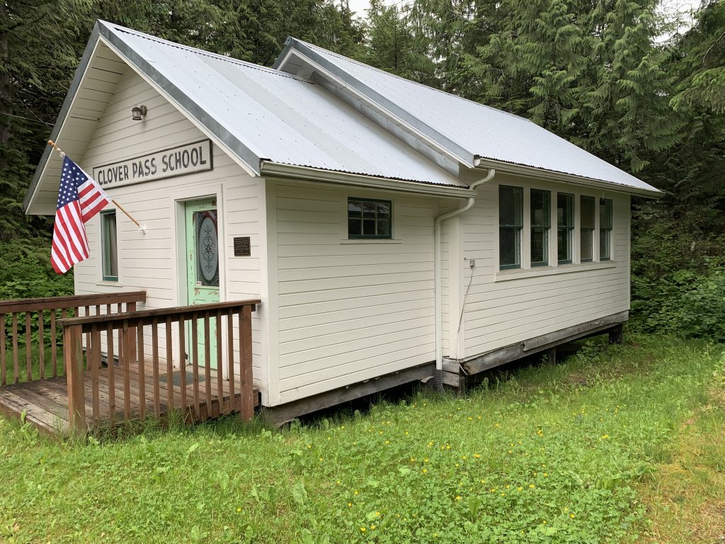
Clover Pass School (Bill Ryan)
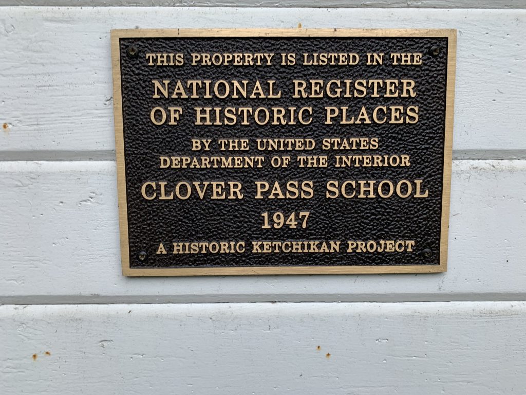
Clover Pass School (Bill Ryan)
Crew change in Ketchikan
Crossing the border into Alaska
I’M SLEEPING ASHORE TONIGHT in a room my brother Bill rented at the Inn at Creek Street, in Ketchikan. Sam Farmer and I reached This Southeast Alaska city at 8 this morning, and Bill flew in from New York later in the day. Sam flies out tomorrow, and Bill and I head for Misty Fiords National Monument.
Ketchikan was bustling today, with tourists from at least three enormous cruise ships filling the streets, and boats competing in the 750-mile R2AK (Race to Alaska) race were beginning to trickle in. On the waterfront shuttle bus I met a crew member from the Sail Like a Girl team, winner of last year’s race. This year they came in fourth, she told me—would have finished third, but they broke a stay. Using only human and wind power, these intrepid racers started at Victoria, B.C. six days after the Osprey, with its twin 50 hp motors, left Kenmore. Some of them beat us here by a day.
Along the way, from Prince Rupert to Ketchikan, we saw:
Floating house tied to channel marker in Chatham Sound
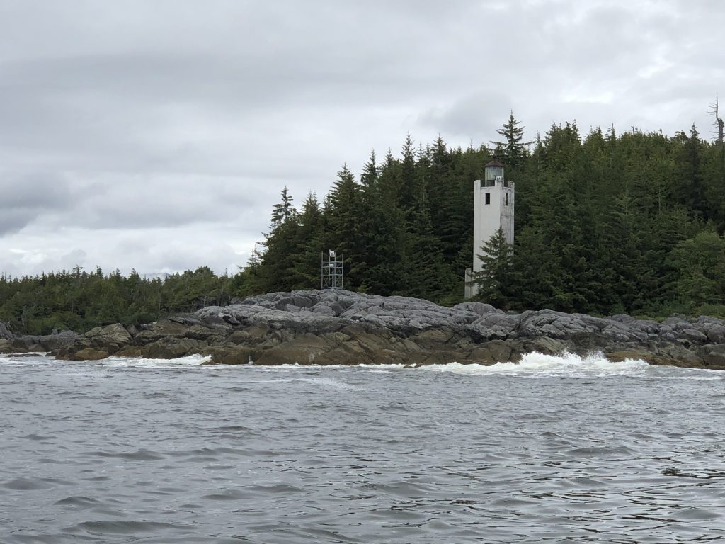
Cape Fox Light

In Foggy Bay
In Foggy Bay
In Foggy Bay
In Foggy Bay

In Foggy Bay
Sam Farmer, Foggy Bay
Sunset at Foggy Bay anchorage
Ketchikan
Why people visit Ketchikan
Kumealon Bay to Prince Rupert
MAN, DID IT RAIN LAST NIGHT. We were anchored in Kumealon Bay, after a slow slog up Grenville Channel from Hartley Bay, and the downpour sounded like someone was pouring gravel on Osprey’s roof. The recaulking work I did on my roof rails earlier this spring proved effective, however, and we had a dry, comfortable night—lulled to sleep finally by the sound of the rain and the gentle rocking of the boat.
Now we’re in Prince Rupert, and after a day of boatkeeping—laundry, showers, tidying—it’s raining again. That’s OK. I’m equipped for it, mentally and gear-wise. This warm, dry little boat is actually a really cool way to observe this very wet place. The crew may require some persuading on this point.
Tomorrow we cross Dixon Entrance into U.S. waters. We have already cleared Customs using the new CBP Roam app, and plan to go as far as Foggy Bay.
Along the way here:
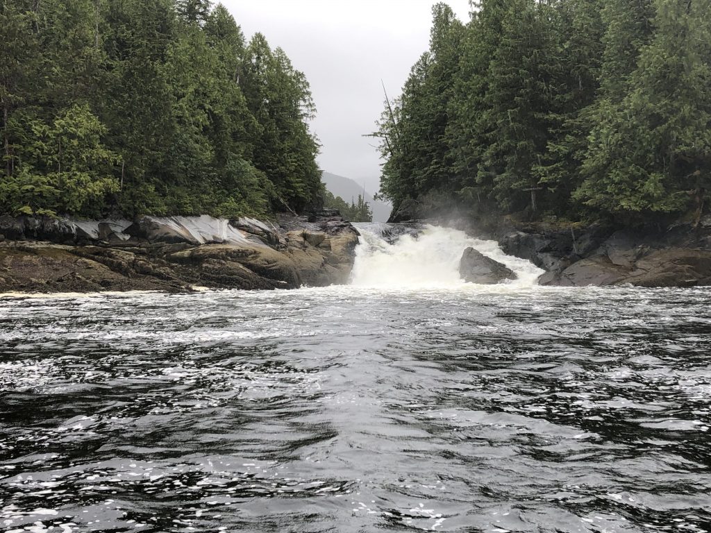
Verney Falls

Light in Grenville Channel
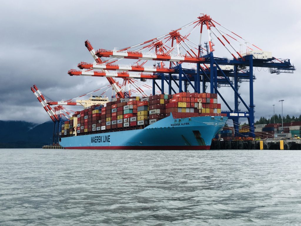
Container ship, Prince Rupert
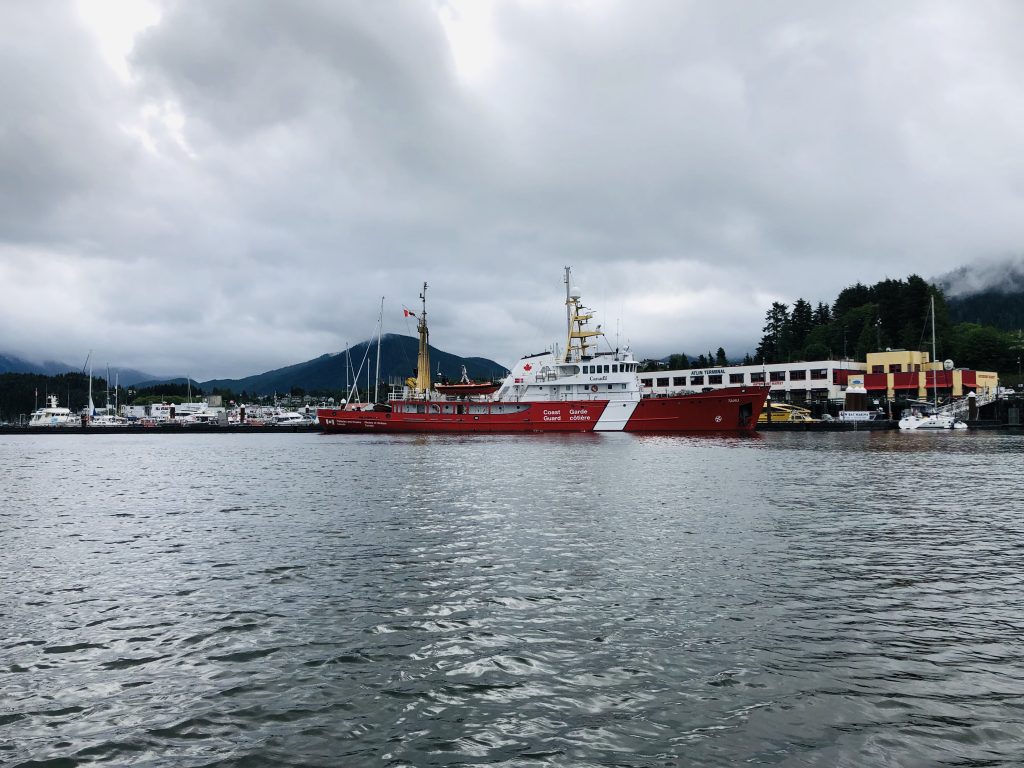
Canadian Coast Guard vessel, Prince Rupert

Sam tying up, Prince Rupert
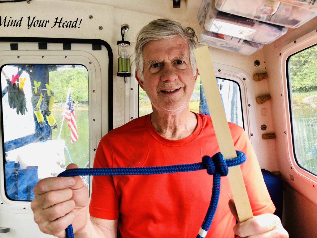
Three knots for sailors
Sam Farmer demonstrates three essential knots for mariners:

Sheet bend
Buntline hitch

Bowline
Dead in the water at Hartley Bay
[contact-form][contact-field label=”Name” type=”name” required=”true” /][contact-field label=”Email” type=”email” required=”true” /][contact-field label=”Website” type=”url” /][contact-field label=”Message” type=”textarea” /][/contact-form]
THERE WAS A TACO PARTY at the Hartley Bay dock this afternoon, where a half-dozen boaters are waiting for gas. The 2019 Waggoner Cruising guide alleges fuel is sold weekends at this neat little First Nations village on Douglas Channel. We all believed the guide book—and now we’re waiting for tomorrow, Monday, when it is said gas sales will resume.
This is the last gas stop on the way north to Prince Rupert, and none of the boaters stuck here (some who have been waiting here since yesterday) has enough fuel to proceed.
It doesn’t matter. Sam and I planned to dock here overnight anyway, and we’re tied up right next to the taco party, and have been invited to a strip steak party later this afternoon.
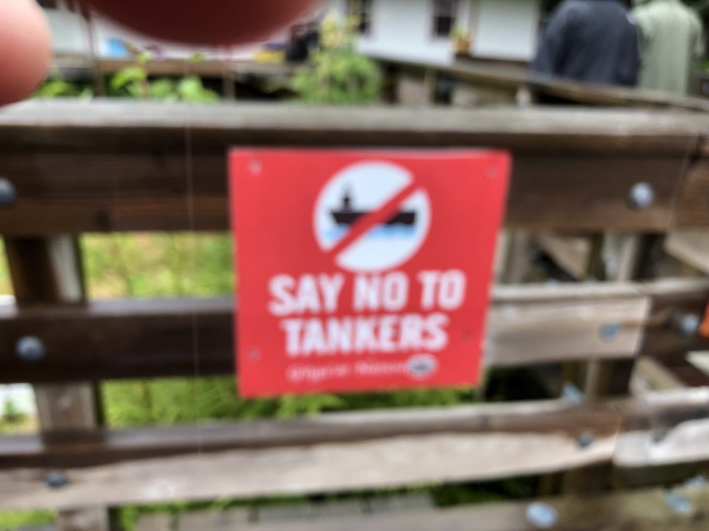
While we waited for gas and steak, we went for a walk around the village. Hartley Bay is home to the Gitga’at Nation. The Gitga’at people Tsimshian, and traditionally a matrilineal society. Clans affiliation, crests, names, and resource gathering areas are inherited from the mother’s side of the family. The village is located at the mouth of Douglas Channel, about 630 kilometers north of Vancouver and 145 kilometers south of Prince Rupert.
According to the Gitga’at website, “The wellbeing of their people is intricately related to the health of their lands, waters, and resources, and the community continues to work to sustain their abundance and richness.” We see some evidence of that in the “Say No to Tankers” signs.
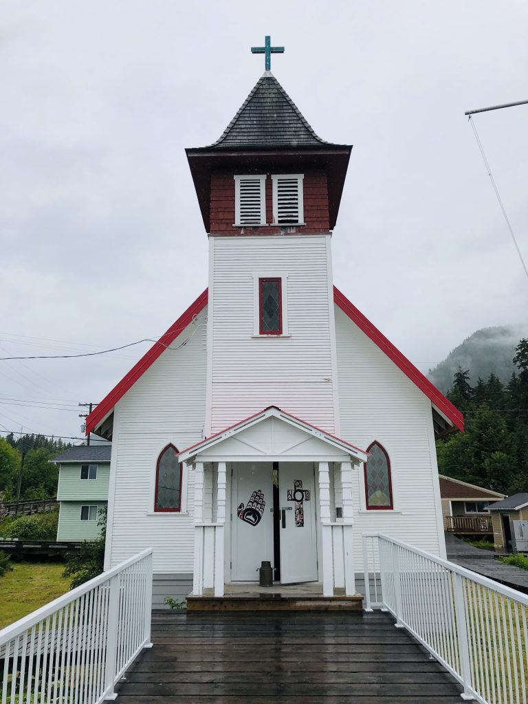
The village’s buildings are connected by boardwalks, and there are no cars—just golf carts and ATVs. This Sunday there are few people on the boardwalks. Fewer than 200 Gitga’at live in Hartley Bay year round, another 450 or so live off-reserve. The only two public buildings opened this Sunday are the little Emmanuel United Church and the community center. The door to the church was open. Worship services are held year round, and there were flowers at the altar and hymnals in each pew.
The door to the community center was open, too. There was a sign, “No restrooms. Please don’t ask,” a reminder that rural public utilities are often limited. There are no public restrooms on the dock or anywhere in town that we could find. So we headed back to the boat.
I haven’t blogged since Alert Bay, and in those five days we have traveled 327.7 nautical miles—for a total of 652.6 NM since the trip began. We have 178 more to go before we reach Ketchikan.
Some of the sights we’ve seen along the way include:

The door to the community center was open. There was a sign—“No restrooms. Please don’t ask”—a reminder that services are generally limited in the small villages along the Inside Passage. There are no public restrooms on the dock or anywhere in town that we could find. So we headed back to the boat.
I haven’t blogged since Alert Bay, and in those five days we have traveled 327.7 nautical miles—for a total of 652.6 NM since the trip began. We have 178 more to go before we reach Ketchikan.
Some of the sights we’ve seen along the way include:
Islets in Queen Charlotte Sound
Our anchorage at Fury Cove
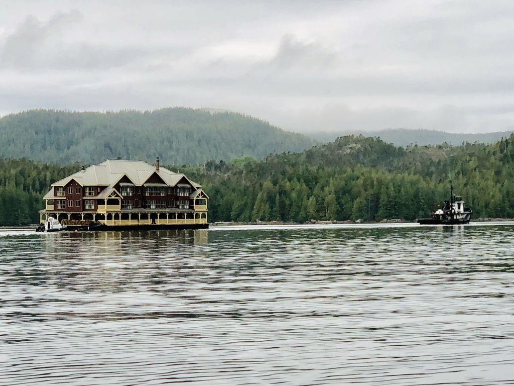
A huge three-story lodge being towed north through Lama Passage, near Bella Bella
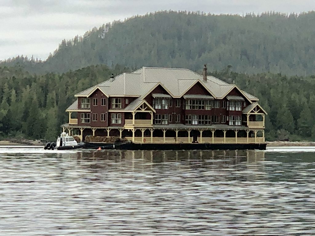
Look at the size of this sucker
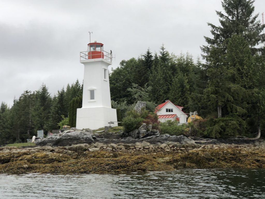
Lighthouse at Dryad Point
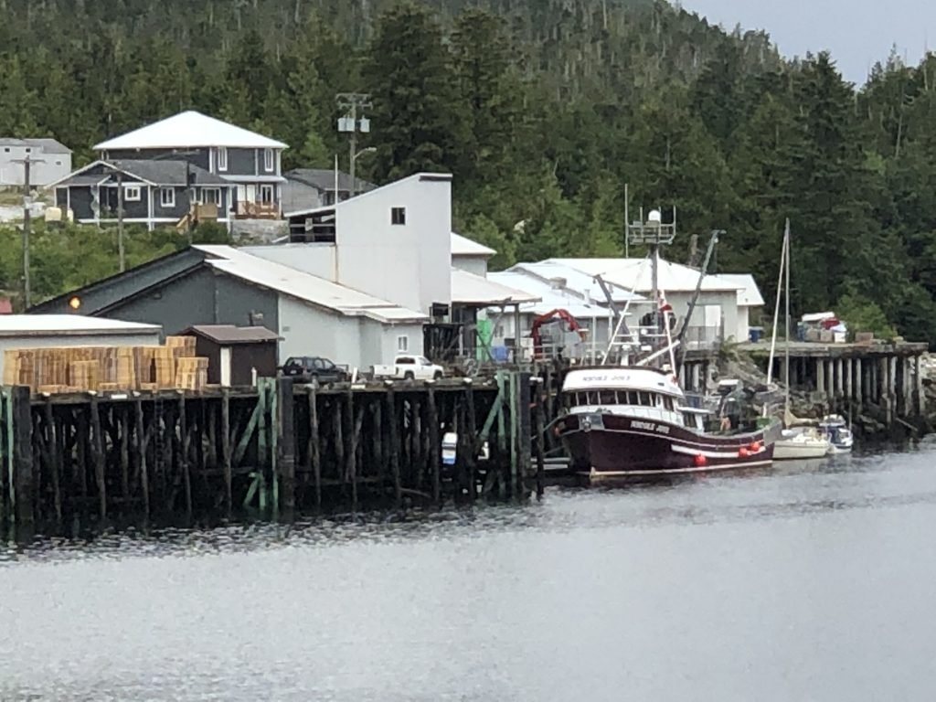
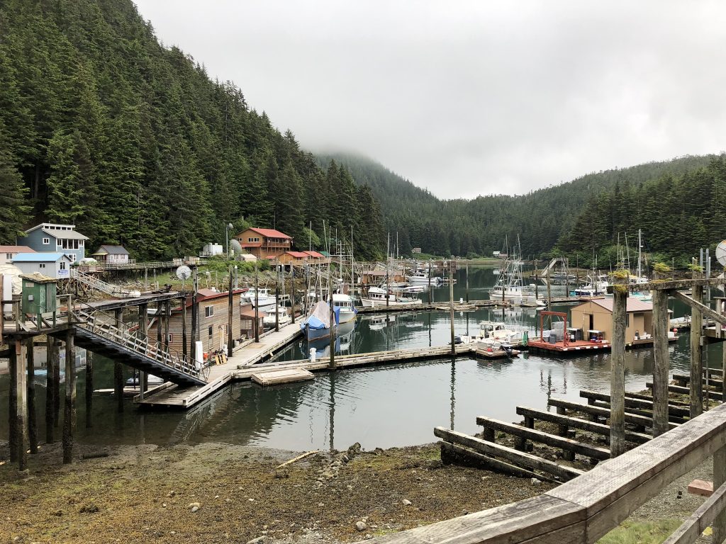
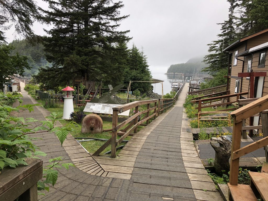
Public dock at Klemtu


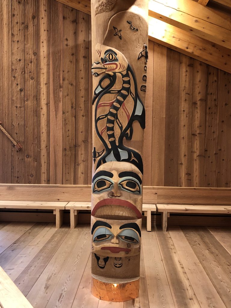
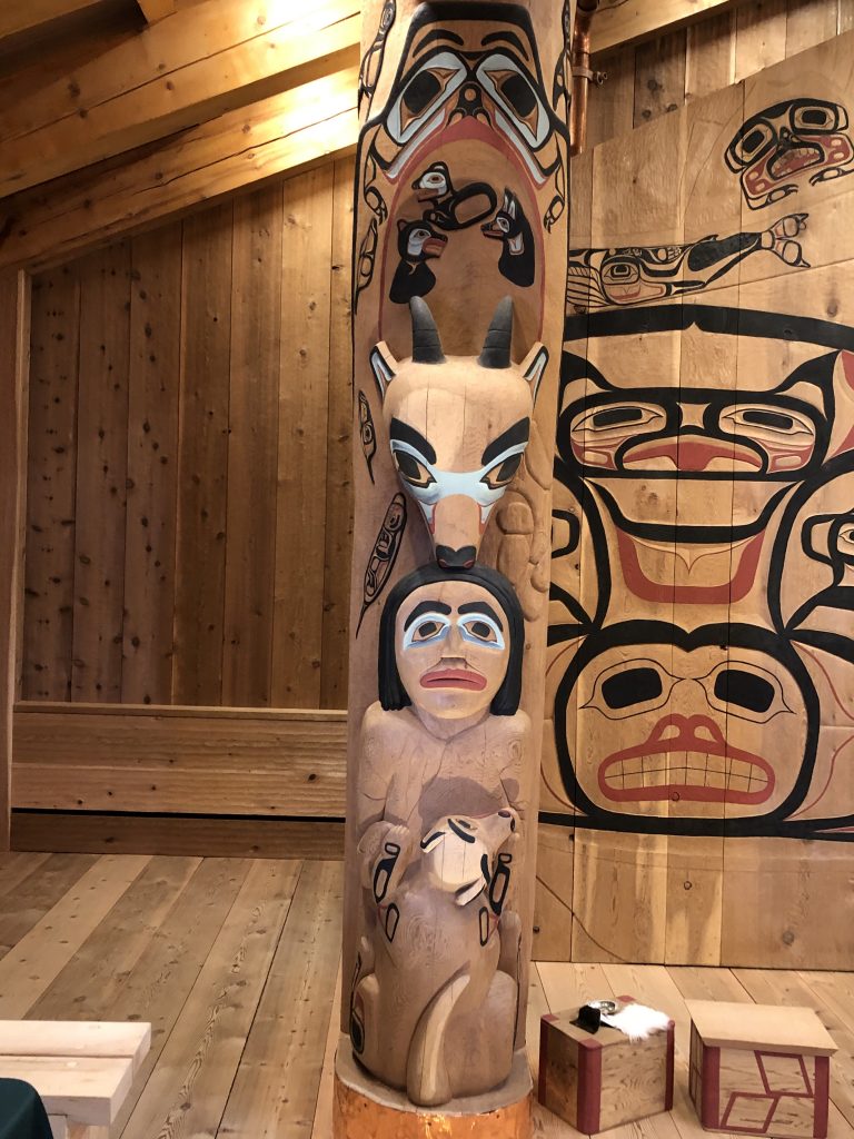
Totems, in Klemtu longhouse
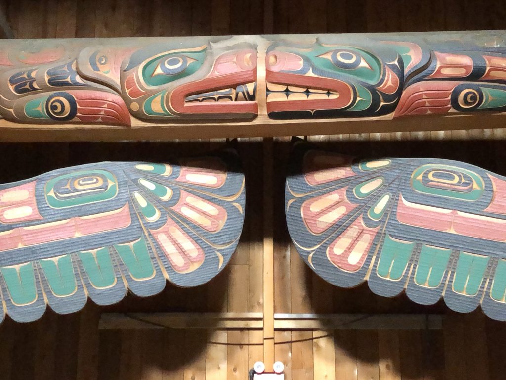
Detail
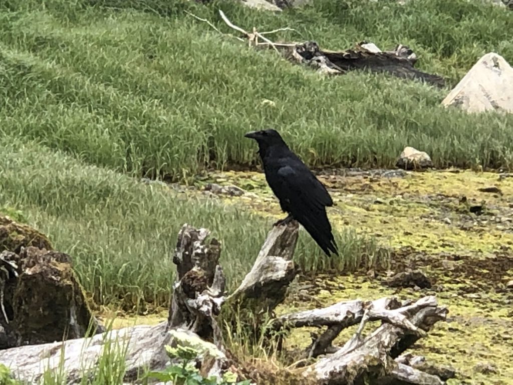
Our first raven
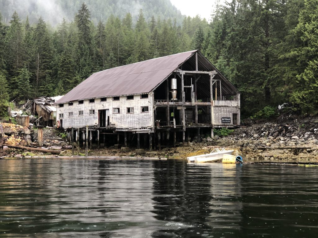
Abandoned cannery at Butedale
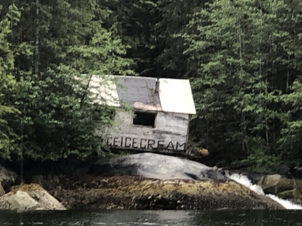
Melting away

Butedale Passage